Quantcast
Channel: Beit Emmett
Viewing all 432 articles
Browse latest View live

Road Trip: New Hampshire and Vermont

$
0
0

Today we headed north to Sharon Vermont, he birthplace of Joseph Smith. The memorial obelisk (installed with great effort in 1905) marks the site of the Smith home where Joseph was born on December 23rd 1805. Sister Like came inside the visitor center to have us come out and see how the top pyramid brightly reflects the sunlight at certain times of the day. 


Happily Elder Like catered his tour to our kids. Will was very reluctant to join in any form of guided tour and even stayed in the car for a little while. When he did come in, Elder Like captured his attention by telling the story of six year old Joseph having his leg operated on down to the infected marrow of his bone (a side effect from typhoid that had spread through the large family). A brave Joseph turned down any offering of calming/numbing alcohol. All he needed was his father to hold him down and his mother to leave the room so she would not see his suffering.  At the time the Smith family was living in Lebanon New Hampshire just a few miles south of Hanover and Dartmouth College where faculty member Dr. Smith (no relation) was the pioneer founder of this type of leg surgery which was not yet being done anywhere else. The operation saved Joseph's life.


After offering to take a family photo, Elder Like asked if we would like a golf cart ride (he knows how to keep kids interested). Will perked right up. We "four wheeled" down the hill to the foundation site of Lucy Mack Smith's parents' and brother's home.


Here is an original stone bridge along the old pike road bed that ran besdie the Mack homes. We then picnicked on supplies purchased at Trader Joe's in Belmont on our way out of town.


From there we headed north on 110 through Tunbridge where both the Smith and Mack families lived for a few decades and where Joseph Smith Senoir and Lucy Mack met. Between there and Chelsea we visited three covered bridges. Two of them had great river banks for playing in. The kids and their dad had great fun taking photos, skipping rocks, exploring and discovering.


While looking for stones to skip Sarah discovered some green river glass (perhaps from an old 7-Up bottle). We then started to find all kinds of things. We felt like river archeologists: pottery shards, brick pieces, smoothed-edge glass pieces (brown ones from beer bottles?), an ocean shell and pieces of equipment. 


The excavation site. It was a fun impromptu activity.


Further north we stopped in picturesque Chelsea for some refreshments at "Will's Store."


The village green and white church of Chelsea.


We then drove along winding road 113 through forest hills and white churched villages to Norwich, also with its church, green and gazebo.


A few miles north of the town square, the Smith family rented a home (above) for their final three years in Vermont.


Pasture to the west of the home is probably part of the land the Smith family tried to farm for three years.


We kept looking for any signs of cultivation in Norwich and this was all we could find. Seems most Vermonters have given up trying to grow anything other than sugar maple trees and grass for cow grazing. On June 4th lilacs were just in bloom and this gardener is still covering temperamental plants. No one wonder the Smith family gave up on trying to make a living in late-growing- season Vermont.

The challenging life of Vermont farmers provides the setting for the first chapter of my book on the history of the Mormon Church in Indonesia. Here is what I hope will be the beginning of my book:


The island of Sumbawa lays three islands to the east of Java, beyond Bali and Lombok. It, like many of the other islands of the Indonesian archipelago, was formed through eons of volcanic eruptions as the power, pressure and heat of the Australian plate subducting under the Eurasian plate forced molten material up through the earth’s cracked curst. One of the most violent of these eruptions was the 1815 explosion of Sumbawa’s Mt. Tambora.
Tambora’s eruption is considered to be the second largest in history. It killed as many as 50,000 people, wiped out a whole language (Tambora) and left the island of Sumbawa uninhabitable for years. The force of its explosion sent a staggering 11 cubic miles of dust, ash and rock into the atmosphere! (By comparison, the famous1883 eruption of Krakatoa to the west of Java only ejected six cubic miles of mountain.) Prevailing winds then enveloped the earth with particulates that blocked out the warming rays of the sun and thus lowered the world’s temperature by an average of one degree Celsius. This “year without summer” brought agriculture calamity to Europe and North America.[1]
In his biography of Mormon Church founder Joseph Smith, Richard Bushmen has this to say about Tambora’s far reaching influence on the farmers of New England, including the Smith family of Vermont:
“In the next two years nature conspired to drive [the Smith Family] from Vermont. The second year on the Norwich farm, crops failed again. Joseph [Smith Sr.] planted the third spring, in 1816, with the resolve to try just once more. The result was conclusive. This was known as the year without a summer. Lucy [Smith] spoke of an ‘untimely frost.’ Actually on June 8 several inches of snow fell all across the highlands of northern New York and New England, and ice formed on the ponds. The entire summer was cold and dry. Famine compelled farmers to pay $3 a bushel for imported corn. As Lucy remembered it, ‘This was enough: my husband was now altogether decided upon going to New York.’”[2]
The Smith family was not alone. Over the next two years thousands of Vermonters migrated in search of literal greener pastures. For the Smith family the greener pasture was the town of Palmyra in western upstate New York. It was here, a few years later that a young Joseph Smith Jr. was directed by the angel Moroni to the Hill Cumorah to unearth golden plates that contained a record of ancient peoples and prophets who lived in the Americas. Joseph Smith translated the record and called it the Book of Mormon.
Had Tambora not erupted, there would not have been a year without summer, and without that cold, dry summer the Smith family may have stayed put in Vermont thus leaving Joseph far from Cumorah and its buried plates. Certainly other factors could have compelled the Smith family to migrate, but for some reason a volcano on an isolated island in the Dutch East Indies served as the catalyst to put a religiously inquisitive boy in the right place to receive the records and to begin a religious restoration.


[1] Winchester, Simon. Krakatoa. pp. 292, 307
[2] Bushman, Richard Lyman. Joseph Smith: Rough Stone Rolling p. 27


From Norwich, Vermont we drove across the adjacent Connecticut River to Hanover, New Hampshire, crowded with what looked like the tail end of graduation festivities at Ivy League Dartmouth. We then headed south eventually deciding to drive into Lowell Massachusetts--a classic industrial mill town situated along a power generating river--where we hoped to find a unique restaurant for dinner. We passed a few Cambodian restaurants, but unfortunately Wendy's won out.


Road Trip: Plimoth

$
0
0

Today was a very rainy day in Massachusetts, but we didn't let that stop us. Marie's sister Betsy joined us (and even drove since she knows the local roads and we have had our fill of wrong turns and wrong roads). Our destination for the day was Plimoth Plantation south of Boston.


The village is a replica of what Plymouth looked liked in 1627, seven years after its founding. The settlement is peopled with modern actors who play the role of being a 17th century pilgrim of Plymouth. The second house we visited was that of John Alden and Priscilla Mullins--16th (or some huge number) great grandparents of both Maire and me. Both were on the Mayflower and married within a year of arrival in America


Here is the modern-day John Alden. I had fun asking him questions about when he and Priscilla got married, if they had children, what they did each day. After all the questions I decided to tell him that my interest stemmed from being a direct descendent of him. True to character he could not acknowledge that he had 21st century progeny. He did however note that he had an uncle that looked like me.


This pilgrim and her husband told us about the home grown herbs she was mashing to add to a porridge of oats. Her husband showed us his musket.


This young lady (the oldest of six daughters) arrived a few years behind her father who came to pave the way. They were not pilgrims, but joined the colony to seek better economic opportunity and to eventually own land. I asked what her favorite church hymn was and she sang us what she sang in her old church in England and then the new world Pilgrim version. She concluded with a favorite song for dancing. Sarah had a hard time getting used to idea of people pretending to be someone else and always staying in character, but in the end she asked some good questions too.


We breifly stopped at the Wamapanoag village with its large wigwam.


Here Native Americans answer questions (from way too many school children on school outings), but not as if they were living in the 17th century. It would have been nice if there was less rain and more opportunities out side to see and hear about these first Americans.


I also am a direct descendant (via Louisa Minnerly Shumway) from a Montauk Indian princess (of eastern Long island). The Montauks are related to the Wampanoags who helped the Pilgrims so I kept reminding the kids that they were seeing in both the pilgrim and Native American villages how their ancestors would have lived. For lunch I enjoyed a Wampanoag platter of local Native American fare: succotash (Sarah enjoyed this too), squash and stuffed quahog (clam). All very delicious.


Next stop the Mayflower 2.


Sleeping on the lower deck.


And finally a grist mill in the center of modern day Plymouth. We learned all about water power and corn grinding.


Road Trip: Boston to Fayette

$
0
0

Friday, with cousin Lucie as our guide with rode the "T" downtown Boston for a walk along the Freedom trail. We enjoyed a beautiful sunny day. We started at the Boston commons and the Massachusetts state house.


To perk up ornery, bored Will,  I bought him a smoothie. The other three shared a cup of the extra (given free by the nice clerk at Walgreens).


Joel's new hat.


The balcony of the old state house from where Bostonians first had the Declaration of Independence read to them. 

Paul Revere's house.


Interesting array of flags in front of Boston City hall.


First integrated Church in the USA.


Mennonite missionary choir in the Boston Commons.


Boston Public gardens


Swan, nest and egg.


Jewish family feeding the ducks before the advent of Sabbath. When the wife and daughter joined them I offered to take a family photo.


Make way for ducklings


Lexington Green


Concord "minute men." Will never found a Boston hat to buy (we refused to buy a $28 official red sox hat that he wanted) so in Concord he bought a nice walking stick the kept him entertained using it as a gun, to draw in the gravel, to poke at things etc. etc.


Last stop of the day, the Boston (Belmont) Temple. The original plan was to have a taller steeple, but the fair citizens of Belmont would not approve. The temple was dedicated without a steeple. The belligerence of Belmont prompted liberal, Catholic, democrat, senator Ted Kennedy of Massachusetts and conservative, Mormon, republican senator Orrin Hatch of Utah to work together and pass the Freedom of Religion act that granted all religions the right to build places of worships in any municipality. A shorter steeple was then added. Years later when Muslims wanted to build a Muslim community center and mosque a few blocks north of ground zero in lower Manhattan, Senator Hatch impressively supported the much opposed mosque. I do not always agree with Senator Hatch but on this occasion I was proud that he was willing to apply the principles of his act to all, including Muslims.


While in NYC we walked by the "ground zero" mosque site on Park Street. I went in to see the progress and was told in the temporary mosque that the plan is to demolish the building and finally build the intended Muslim community center.  See more from my visit here in 2012: http://beitemmett.blogspot.com/2012/03/geographer-in-new-york-city.html


Saturday morning we headed west again via I-90. This is a photo of the hills and trees of western Massachusetts' Berkshires so the kids can see what they missed while watching videos and playing i-phone games.


We took a side trip into downtown Albany in quest of a good view of the Hudson River.


Next stop was in Seneca Falls at the Women's Rights National Historical Park. It commemorates the 1848 First Women's Rights Convention held at this simple Wesleyan Methodist Church


The adjacent visitor center had a nice movie and some great displays about the early days of the Women's Right's Movement.


Elizabeth Cady Stanton on the far left was one of the main leaders (she is flanked on the right by Fredrick Douglas who attended in solidarity of rights for blacks and for women) and was the one who read the declaration of sentiments. She and her colleagues had great vision. Marie noted how interesting it is that the Finger Lakes region of New York in the mid 1800s was such a center of change, both religious and civil.


Driving through Waterloo in route to Fayette we happen to cross over the Seneca-Cayuga canal that links these two Finger Lakes which are then linked to the Erie Canal. One U-turn later, and we were able to watch a small fishing boat transit the lock.


Our final stop was at the Peter Whitmer farm in Fayette, New York. Here in this reconstructed farm house, Joseph Smith finished his translation of the Book of Mormon and on April 6, 1830 The Church of Jesus Christ of Latter-day Saints was organized.


The upstairs translation room.


In near by Seneca Lake, baptisms were held including that of Joseph Smith Sr.


In near by forests the angel Moroni showed the golden plates to the three witnesses. He also showed them to Mrs. Whitmer who had been so kind in opening up her home and taking car of Joseph and Emma and others.

The visitor center displays were recently re-done.


Included in the new displays is this new original painting of Jesus.

Road Trip: Pilgrimage to Palmyra

$
0
0

Sunday was a great day. We set out from our Holiday Inn express in Victor NY ten minutes past our intended departure time of 8:30. I had estimated it would be about a 20 minute drive to the LDS Church in Palmyra. I guessed right. We pulled into the parking lot right at 9:00 (we are seldom so late for church) and were in our seats in the over flow section of the chapel with many other tourists before sacrament meeting started. After Sacrament meeting we headed out to see the sites. Had we inquired of the many missionaries at church we would have found out that none of the LDS sites open on Sunday until 12:30 after the full three hour block of meetings. In the church parking lot, I asked the leader of a bus of youth (who were also at the Whitmer farm the same time as we were yesterday) where they were going first. When he said the Sacred Grove, I decided we would go in the opposite direction to the Hill Cumorah. When we got there we found out the visitor center wasn't open so we elected to climb to the top.


While on top of the drumlin hill, we read from Joseph Smith History in the Pearl of Great Price about the angel Moroni visiting 17 year old Joseph three times in one night in his attic bedroom, how Joseph was directed to the Hill Cumorah where plates were buried, and how he was instructed to visit the plates once each year for three years and then on the fourth year he was allowed to take the plates and begin translating them. After reading we sang "An Angel From on high" which was also sang on the hill top by President Joseph F. Smith in 1905 on his return from dedicating the monument in Sharon Vermont. (reading scriptures on site and singing a related hymn is a fine tradition now carried on from our year in Jerusalem)

An angel from on high
The long, long silence broke;
Descending from the sky,
These gracious words he spoke:
Lo! in Cumorah's lonely hill
A sacred record lies concealed.
Lo! in Cumorah's lonely hill
A sacred record lies concealed.
Sealed by Moroni's hand,
It has for ages lain
To wait the Lord's command,
From dust to speak again.
It shall again to light come forth
To usher in Christ's reign on earth.
It shall again to light come forth
To usher in Christ's reign on earth.


All that is known about where the plates were buried was that it was on the west side near the top of the hill.


Each July a pageant about the Book of Mormon is held on the western grassy slope of the Hill Cumorah. I saw it when I was 15 years old when I went on a one month eastern bus tour for LDS youth. I have been back to Palmyra several times since then, but never to see the pageant. Pageant visitors spread out on blankets in the flat grassy area to watch. While a student at BYU I drove with a friend back to DC for our Washington Seminar internships. My friend Richard Sopp had served his mission in Canada so we planned our road trip to go through Ontario and Quebec. He arranged for us to spend one night in Smith Falls Ontario with the branch president (BP) of a branch Richard served in. That evening we got talking about Canada and the US. The BP expressed frustration that most American know very little about Canada and yet Canadians know much more about the US. To make his point he told us that each year his family would go to the Hill Cumorah Pageant. There the missionaries would canvas the crowd greeting people hoping to share a gospel message. When the BP and family were approached by the missionaries and asked if they were LDS or not, and if not, would they like to know about the Book of Mormon etc, the BP would always tell a white lie and say they were not LDS. The missionaries would then asked if they wanted to learn a little about what they would be seeing that night. The BP would then say: "I understand that you have been missionaries in upstate New York for a year or so. Canada is just across the border. If you can tell me the capital of Canada I will listen to your message." In all of his years of trying the same thing, he never met a missionary that knew that Ottawa was the capital of Canada. This proved his point, Americans know little if anything about Canada. To rectify this gross deficiency in geographic awareness and to help American learn more about Canada so that Canadian Mormons and all Canadians can feel better understood, I now make sure my geography students learn about Canada. On the fist day of class in both my Political Geography and World Geography classes I always ask in the introductory quiz for students to name and label the location of Canada's Capital. In my 22 years at BYU, the running average for knowing the answer is about 15%. Usually students will say Montreal or Toronto (cities that do or did host major league baseball teams are more well known), Alberta (a province) also shows up sometimes. Knowing capitals is a fun part of geography, but more important is understanding the why behind the city or place. I then ask the students why Ottawas is the capital of Canada. Few know, even some of the Canadian students don't know. The reason is because it is a compromise capital between the rival cities of French speaking Quebec and Montreal and English Speaking Toronto. It was hoped that by moving the capital to more neutral Ottawa the bickering French and English Canadians would have fewer reasons to deepen their divide. And that is a geography lesson that comes from Cumorah.


From Cumorah we drove through Palmyra looking for a park for our picnic lunch.  A few blocks north of the four church intersection we found a park alongside the Eire Canal. Displayed spanning the now filled original canal bed was a changing bridge where humans and mules towing barges on the Erie Canal could shift from one side of the canal to the other while still towing.


Also in the park was an original aqueduct where the Erie Canal was carried over a stream via a wooden conduit atop the rock arches.The Erie Canal introduced cheap transportation to and from the region. Because of the canal Grandin could afford to ship a the printing press to Palmyra, That press was then used to print the Book of Mormon. The canal was also used to send forth missionaries, to bring in interested people (like Parley p. Pratt) to meet Joseph Smith and for the saints to migrate to Kirtland.


Running parallel to the original path of the Erie Canal (now a bike path) is the enlarged new Erie Canal and one of its many locks--lock 29.


Next stop was the nearly empty Sacred Grove (now vacated by the teens).


We selected a bench and read Joseph Smith's account of his prayer of faith to know which of all the churches was correct. The answer to his prayer was the appearance of God the Father and His Son Jesus Christ. Read the story here, verses 3-20.  https://www.lds.org/scriptures/pgp/js-h/1?lang=eng


We then sang this hymn:
  1. Oh, how lovely was the morning!
    Radiant beamed the sun above.
    Bees were humming, sweet birds singing,
    Music ringing thru the grove,
    When within the shady woodland
    Joseph sought the God of love,
    When within the shady woodland
    Joseph sought the God of love.
     
  2. Humbly kneeling, sweet appealing--
    'Twas the boy's first uttered prayer--
    When the pow'rs of sin assailing
    Filled his soul with deep despair;
    But undaunted, still he trusted
    In his Heav'nly Father's care;
    But undaunted, still he trusted
    In his Heav'nly Father's care.
     
  3. Suddenly a light descended,
    Brighter far than noonday sun,
    And a shining, glorious pillar
    O'er him fell, around him shone,
    While appeared two heav'nly beings,
    God the Father and the Son,
    While appeared two heav'nly beings,
    God the Father and the Son.
     
  4. "Joseph, this is my Beloved;
    Hear him!" Oh, how sweet the word!
    Joseph's humble prayer was answered,
    And he listened to the Lord.
    Oh, what rapture filled his bosom,
    For he saw the living God;
    Oh, what rapture filled his bosom,
    For he saw the living God.

To each his own!


The western boundary rock fence built by the Smith's to demarcate their 100 acre farm. They did not clear all of the land. This grove was left to provide maple sap and building and barrel making timber.


The Smith farm in Palmyra was much more productive and better suited geographically than their Norwich Vermont farm.


A reconstructed Smith farm house (built on the original foundation) with the Sacred Grove in the distance.


Moroni appeared to Joseph in this upstairs room (while his many siblings slept)


Original painting displayed in the Grandin buiding.


Smith farm land and the Sacred Grove.


Eventually the Smith familhy moved a 100 yards south to a bigger home built by oldest broterh Alvin.


The family of Joseph Smith Sr. and Lucy Mack Smith.


It was to this home that Joseph brought the plates. He had quite a time trying to protect them from mobs and thieves. Once night he had his two younger sister hide the plates between their legs and under the covers. Soon there after a mob came looking ofr the plates, but could not find them. They didn't want to disturb the "sleeping" girls.


Once the plates were hidden under the hearth stone. Other times they were hidden in the tool box on the far dresser.


This large and old black birch on the south side of the home was planted the year Alvin died.


The Smith's built a threshing barn (this one was brought from Brigham Young's New York farm).


The Smith's also made money building barrels is this cooper shed. The plates were hidden here in the rafters and in a barrel of beans.


The restored Grandin bookstore and printing press.


Original ceiling and floor boards


A replica of the original press where the fist 5,000 copies of the Book of Mormon were printed.


Once printed the pages were lowered to the second floor to be pressed and bound.


An original copy of the Book of Mormon.


The original painting of Mormon abridging the plates.


The original painting of the Book of Mormon account of Christ visiting the Americas.


 Original paintings by pioneer artist C.C, Christensen of Book of Mormon events: Lehi prophesying in Jerusalem.


Nephi and brothers building a boat.


Lehi blessing his posterity


The Book of Mormon has been translated into many languages.


To make sure Mormons could never be accused of proselyting in Israel as promised in order to get the BYU Jerusalem Center built, the Book of Mormon in Hebrew was pulled from distribution (I have been told that any copies of the Book of Mormon in Hebrew that were in Israel were burned along with other church materials published in Hebrew).


Editions of the Book of Mormon in Arabic (lower right), Turkish (Mormon Kitabi), Indonesian (Kitab Mormon), Persian/Farsi, Urdu and Malay (not on this display) all use kitab, the Arabic word for book in the title.


The Philippines has many options


The center of Palmyra with a church on each of the four corners of the center intersection. No wonder young Joseph was confused.


A block north of the intersection in the lot where Palmyra's first church and school were located is the grave of Alvin Smith.


Years after his death, Joseph had a vision of heaven in which he saw his brother Alvin. This confirmed to Joseph that  un-baptized souls are not condemned to hell, but will have the opportunity in the next life to accept the gospel of Jesus Christ.   https://www.lds.org/scriptures/dc-testament/dc/137?lang=eng


The 14 year old Palmyra Temple. Built on the eastern portion of the Smith farm.


All of the windows have stained glass images of the Sacred Grove.


We then doubled back to the Hill Cumorah Visitor Center for our final stop. There we watched a nice video about the restoration  https://www.youtube.com/watch?v=XGHMhQFvlIw.

And one of the senior missionaries told us the story of "Terrible Ted." He owned a small plot of land needed to build this temple. He refused to sell at a fair price. Finally President Hinckley said to give him what ever he asked and so the LDS Church paid him a very high price for his land so that the temple could be build. Ted then demanded that the church build him his dream home. Pres. Hinckley said to do that too, with the agreement that when he died the church would own the home. With his new wealth, Ted bought some snowmobiles. One day on a snowmobile outing he crashed, hit his head and died. His newly built home is now the home for the Palmyra Temple President and his wife.

Sunday dinner at Chilies in Victor (just as heavy rain started to fall) followed by a movie night watching How Rare a Possession about two amazing conversion stories based on reading the Book of Mormon. The kids liked it. Parley P. Pratt's conversion story has always been one of my favorites.

You can watch the hour long movie here: https://www.youtube.com/watch?v=75D5UEPwP-Y

Road Trip: Palmyra to Chicago

$
0
0

Monday we drove from Victor to Buffalo and then across the border into Niagara Falls Ontario Canada. The falls are amazing.


We all loved the ride up to the base of Horseshoe Falls on the Canadian version of the Maid of the Mist--the Hornblower.


Subway was our best open for a quick lunch. We resisted temptation to spend lots of money on the Street of Fun with it arcades, museums, games etc. I don't think this part of Niagara is on Marie's return list.


Both border crossings were quick and easy, We brought a notarized letter from the Pritchetts stating that we had permission to drive their van lest Canada think we were trying to bring a stolen car into the country, but didn't have to use it (although we did need it when we went to retrieve our towed car so I guess it is good we per-planned to cross into Canada). And our children's' three expired passports (one month ago) got them back into the U.S. and we didn't need to use their just-in-case birth certificates.


We then drove via the New York, Pennsylvania and Ohio turnpikes (a fancy word for toll-road) to Kirtland Ohio. Can I just say that I am not a big fan of limited entry toll roads. Exits are farther spaced than usual interstates, getting on and off takes more time, and the service stops offer limited food options and higher priced gas and food. Also, my needed driving boost of Dr. Pepper is not always easy to find "back east." We got to historic Kirtland to enjoy the introductory movie at the visitor center. Dinner at Bob Evans (just OK).


Tuesday we started our visit at the Newel K Whitney Store. The Whitney's were prosperous merchants who joined the Church when Parley P. Pratt and three other missionaries arrived in Kirtland and started preaching. They then welcomed Joseph and Emma Smith to live and run the Church from their store building.


corn cob checkers


The store was also the post office


Kirtlanders would bring in goods for barter that the Whitney's then sold to others in town or exported via the Erie Canal to east coast markets.


This upstairs room (with original table) is where the Smith's entertained visitors and ran the Church are where several revelations were received.


Also upstairs was a room that was used for the first year of the School of the Prophets.


This upstairs storage room is where hired hand Orson Hyde (who converted, became and apostle and traveled to the Holy Land to dedicate it for the return of the house of Israel) slept.


The Whitney Store and several other historic buildings are located in the river valley where the two main roads intersect. The temple was built on the hill (top center). A few decades ago the LDS Church got permission (after many years of trying and with the help of 49ers quarterback Steve Young) to have the city of Kirtland re-route the main road around the Whitney farm area so that the historic area could be restored and be a pedestrian zone.


Two of the additonal buildings in this zone are a rebuilt water powered saw mill (front) and an Ashery (rear)--where the ashes from Kirtlanders' fires were processed into potash that was then used to make soap and as a fertilizer.


These two paintings of the building of the Kirtland Temple and of the visit of Jesus to Joseph Smith and Oliver Cowdery in the temple are displayed in a reconstructed boarding house that is used as an LDS vistior center for the temple since the real Kirtland Temple is owed by the Community of Christ (formerly known as the Reorganized Church of Jeus Christ of Latter-day Saints). The Community of Christ has an interesting movie about the history of Joseph Smith and the church in Kirtland. The movie and the 80 minute guided tour of the temple are mostly in sync with the LDS version, but there are some differences too. No photos were allowed in the visitor center or temple.


The orignal front door.


The two lower floors are large assembly rooms with priesthood pulpits on both ends. The dedication service was held in the first story. The second story was for priesthood meetings and training and the top floor held four rooms used as classrooms, the school of the prophets, and an office for Joseph Smith.


The pulpit behind the lower center window is where the Savior appeared.


Next we drove south (eating PB&J sandwiches along the way) 40 minutes to Hiram Ohio and the John Johnson farm. Since my first visit at age 16, this had been a favorite church site, well worth the trip off the beaten path. The Johnson family (as explained by the senior missionary couple) were, like teh Smiths, Tambora refugees who fled Vermont for the greener pastures of Ohio after the failure of the year without summer. They established a large dairy farm and exported homemade cheese via the Erie canal to New York City.


When they built their home they dug a cistern first so that rain water from the roof would collect below and could then be pumped up into the summer kitchen.


The house was long inhabited after the Johnson sold the farm to help buy the temple lot and moved to Kirtland to run a boarding house. When the LDS Church restored the building they removed multiple layers of paint down to the original (seen on the inside of the door) rust and mustard designs of Sister Johnson. The fireplace in the main kitchen was one of four centered on a central chimney that was built on a very firm foundation at the core of the home.


Sarah loved the colors used in the home--including this painted checkerboard floor . She saw Sister Johnson as a kindred spirit. This main floor parlor/sleeping room is where Joseph and Emma and their twin babies were sleeping the night Joesph was pulled from his bed by a mob and taken out and tarred and feathered.


(More original fun colors--perhaps chosen to combat the grey of the long Ohio winters.) Upstairs in a room accessed by a side entry stair was the room where the Johnson let Joseph Smith use as an office during the year he and Emma found refuge in their home.


Over a dozen revelations now included in the Doctrine and Covenants were received in this room. Here is Joel reading the testimony of Joseph Smith from Section 76 (received in this room) which teaches about the three degrees of glory.

 22 And now, after the many testimonies which have been given of him, this is the testimony, last of all, which we give of him: That he lives!
 23 For we saw him, even on the right hand of God; and we heard the voice bearing record that he is the Only Begotten of the Father—
 24 That by him, and through him, and of him, the worlds are and were created, and the inhabitants thereof are begotten sons and daughters unto God.


We then set out for a long 6 hour drive to Chicago. We detoured into South Bend to see the campus of Notre Dame and to find some dinner (Wendy's again!). Then in Gary Indiana the closure of I-80 sent us off on a detour that soon fizzled when we lost rack of the direction signs in a dark, rainy industrial area. We headed west in the rain and eventually found our way back to the interstate and on to our SW Chicago hotel.


Thursday morning my brother Jake drove 3 hours from his home in Chaleston IL to join us for a fun day in the city.  We drove to Hyde Park on the south side via Cicero, 79th and Cottage Grove streets. We transected some the poorest neighborhoods of Chicago. We had fun, just as I did nearly thirty years ago, noticing all of the interestingly named store front churches in these African-American neighborhoods. I regaled everyone with stories from my driving through these and other south side neighborhoods picking up seminary students and scouts as part of my church callings during my three years (1985-88) in Hyde Park. We spent most of the day in Hyde Park. These ivy covered windows are in the the University of Chicago's Oriental Institute.


Here were are in front of Pick Hall which housed the Geography Department.


We stopped on the third floor to say hello to my dissertation adviser and mentor--Marvin Mikesell--who still teaches and comes into his office most every day of the week (including weekends) even though he is long past the age of retirement. He still has a great memory, keen wit and a knack for telling stories. He amused the kids by telling them how worried he was over whether or not this unmarried Mormon man would ever find a wife. He was happy to see me married and with three children!


This ivy covered building housed the dean's office (a sociologist who successfully lead the charge to drop the U of C's geography graduate program the year I arrived) and the Middle East Sutdies Center where after my first year I came to find out that I had miraculously been granted a FLAS fellowship which then paid my tuition and gave me a living stipend for the next two years--all I needed to do was take an Arabic class each semester (Thanks US Government). I still remember walking out of the door of this building after getting the good news and looking heavenward to say "thank you" and to apologize for having murmured and doubted.


The majestic Harper Library (now minus it many book shelves).


The book store where I worked 20 hours a week my first year of grad school, which gave me less time to study Arabic---which made we worry that I would never be able to get any funding.


Outside Regenstien library. A monument (atomic bomb cloud) in the place (under the old football bleachers) where nuclear fusion was invented in 1942.


Gotta love gargoyles


We had fun finding used books at Powells. Then we all enjoyed stuffed pizza (spinach is my favorite) at Giordanos.


Our final stop was the wonderful Science and Industry Museum.


Loved this huge train set showing how trains move goods between Seattle and Chicago.


Learnign about how tornados are formed.


We then drove via Lake Shore Drive to the Loop to get a view of downtown. Traffic was horrible (it was rush hour).


We bailed after making it to part of the magnificent mile and headed towards our hotel. We skirted China Town and Little Mexico via 31st and Archer hoping to find some good Mexican food. I wasn't quite sure where I was going or what we would find, but we found a winner. Everyone found something good to eat. We all loved the chips and salsa and fresh lemonade. I loved my civiche. A delightful day in my old stomping grounds. Happy memories.

Road Trip: Nauvoo

$
0
0

Thursday morning we headed southwest from Chicago across Illinois via interstate (I-55) and by-roads (US136) through the heart of the corn belt (aka the soy bean belt).


Soybeans are grown in rotation with corn because soybean plants add nitrogen to the soil while corn plants deplete nitrogen from the soil.We stopped in Havana to buy fruits and vegetables to go along with our PB&J sandwiches (the kids have discovered that apricot jam is pretty good).


Our first stop was Carthage Jail, where Joseph and Hyrum Smith were martyred by an angry anti-Mormon mob on June 27, 1844. (When will this world be rid of religious hatred?)


Joseph fell to his death in a volley of gun fire from the upstairs window above the well.


After checking in at the delightful and comfortable Krumperman "B & B" (Marie's youngest sister Jeanne's husband Paul Krumperman's parents live in Nauvoo a few blocks form the temple and graciously opened their home to us), we went to the LDS visitor center for an introductory film about Nauvoo and to figure out what of the many things to do in Nauvoo we would do over the next few days. First on the agenda was a fun performance of Sunset on the Mississippi in which all (even if they had no singing or dancing talents) of the senior missionary couples, the Nauvoo brass band, and the very talented young performing missionaries (serving special volunteer four months missions acting, singing and dancing all day and night long) performed fun songs and skits. I don't recall my brother Bill having to sing and dance when he was a young missionary called to serve in the Nauvoo mission as a guide for the last six moths of his mission.


Then we hung around for another treat. BYU's Living Legends were in town for 10 days where they performed each night a combination of Native American, Latin American and Polynesian dances. The impressive dances showed how all of these cultures have traditional beliefs about a great spirit who promised to preserve and bless them as they lived in righteousness. Unfortunately these seasons of plenty and prosperity gave way to seasons of wickedness and war. Then the cycle shifts to a final season or rebirth and rejoicing.


One of the crowd favorites was a Samoan dance called Sasa, Lapa Lapa, Slap. Years ago before we were married Marie and I traveled together (with a DePaul University group) in 1995 through Greece, Bulgaria and Turkey. In Plovdiv Bulgaria we met two LDS sister missaionries in the main town square who invited us to a production that night of the Lamanite Generation (now re-named Living Legends). This BYU performing group was traveling through eastern Europe just a few years after the collapse of communism. The long isolated Bulgarians were delighted to see these energetic talented dancers--they especially enjoyed the bare chested Polynesian men dancers.  


The traditional song of closing: "Go my son."


We were treated both nights to spectacular full moon risings.


We started out the morning with a 9:30 wagon ride around Nauvoo.


We then set out to visit as many of the restored homes and shops as we could in a day and a half. First stop was the log school. Each Nauvoo site has a different emphasis. In the school the kids learned about schooling in Nauvoo, deciphered pioneer spelling and added up how many brick, cut wood and log homes were in the Nauvoo.


In the post office/store we got to try our hand at using a milk/water bucket yoke.


At the bakery we enjoyed yummy gingerbread cookies (free for every visitor--in fact everything in LDS Nauvoo is free). We also went to the brick yard to learn how Nauvoo's red bricks were made.


We all had fun at Pioneer Pastimes. Stilts (easier if the polls are planted behind the arms).


Stick pulling. Joseph Smith's favorite.


Hoop rolling. It took some practice, but Sarah mastered it.


Ring flinging.


Back to the Krumpermans for lunch and then while Will and Marie watched a World Cup game, Joel, Sarah and I enjoyed a quick efficient, enjoyable session in the Nauvoo temple doing baptisms for the dead. This is the largest baptismal font of all the LDS temples--its size is the same size as the font in the original Nauvoo temple. (not my photo). I liked the red brick decor and well as the non-traditional use of darker woods in other parts of the temple.


Afterwards, while Joel and Will finished up the World Cup game, Sarah, Marie and I went to the Lands and Records Office where we looked up all of our ancestors who lived in Nauvoo. Dudley, Wallace, Shumway and Southworth on my side and Bell and Heywood on Marie's.We found out where they lived, marked them on a map, and then downloaded to CD lots of other information about them all.


The three of us then visited the Sarah Granger Kimball home. Sarah and her husband were more prosperous than most. Sarah noticed that many of the men building the Nauvoo temple were in need of new clothing so Sarah bought the cloth and Miss Cook, one of Sarah's hired seamstress, set to work making clothing. The act of reaching out to help others led to other women joining the cause which then led to Joseph Smith formally organizing the women in Nauvoo into the Relief Society. A nice example of bottom up inspiration.


The parlor of the home is where the women of Nauvoo met to plan their relief efforts and is credited with being the beginning place of the Relief Society.


We then gathered up the boys and all went to watch "The Promise" a musical about Nauvoo in the 1840s perfomred by the young singing/dancing missionaries.  We then visited the Nauvoo Women's monuments and had some fun trying to replicate some of them.


Walk around the temple.


 Visit to the Nauvoo pioneer cemetery 


Most of the graves are unmarked and many of them are children. A pavilion at the cemetery lists all those who are buried here. Mary Lemon Bell and James Bell Sr. are the great-great-great-great grandparents of Marie (on her mother's side). James died in Nauvoo in 1844 and Mary Lemon in 1846.  Their orphaned teenage daughter Mary went to live with the Joseph Leland Heywood family. Once in Utah she married Joseph (who was much older) as his fourth wife.


Later that evening we opted to participate in the Trail of Hope. All along Parley Street, along which the emigrant Mormons walked to ford ferries or cross ice to begin their trek west, the young performing missionaries related stories of these emigrants. It was very touching. Many of our ancestors passed this way, including Charles Shumway who has the distinction of being the first to have his wagon ferried across the Mississippi at the beginning of the February 1846 exodus.


Sunset on the Mississippi from the terminus of Parley Street. In a pavilion here, there is a long list of all of the Mormon pioneers who perished in the walk to Zion.


Julia Ann Shumway was the first wife of Charles. Her daughter was then taken care of by second wife Louisa Minnerley (with Montauk Indian ancestry) who is my great-great-great grand mother.


William Caldwell in the oldest brother of my great grandmother Agnes Caldwell Southworth. He stayed behind in Scotland after foolishly joining the Scottish Army just weeks before the family was to emigrate. Years later he finally did some to join the family only to die in Fort Bridger just days before reaching the Salt Lake Valley.


 Moon rise from Parley Street. Last stop of the day was at Annie's for frozen custard.


Saturday morning we started out with a visit to the Community of Christ (RLDS) Nauvoo sites.


The Nauvoo House. Planned and started by Joseph Smith as a hotel but not completed until after the exodus. It is now a dormitory type hostel run by the Community of Christ. The John and Norda Emmett family all stayed here back in 1991 (I think) during our midwest reunion.There were no swarms of mayflies this time around.


The final burial site from Joseph and Hyrum. Originally Emma Smith had the bodies interred underneath the bee house in distance.


The Smith Homestead.


The Joseph and Emma Mansion House which was also a boarding house.


The "Red Brick" store of Joseph where the Relief Society was organized.


There were still many sites to visit, but by now we all had our sights set to the west and home so we chose a final few to visit before our early afternoon departure. We visited the blacksmith shop where we saw how wagons and horse shoes are made. We all got a prairie diamond ring made out of a horse shoe nail.


Daylight visit to see the wagon ferry at the end of Parley Street.


Parley Street looking east toward the Seventies Hall.


The lot behind the blue sign was where Joseph Heywood had his store.


A block east behind the stop sign was the lot of George Benjamin Wallace.


The home of one of Nauvoo's midwives and a good example of how most of the homes in Nauvoo looked.


 Lyon drug and variety store.


Lyon was a trained pharmacist who relied heavily on herbal medicines.


The death of the Lyon's daughter at age two led to Joseph Smith's first teaching about the doctrine of salvation of deceased children and that children did not need baptism until age eight.


Being taught how to find a honey tree: put a blossom in a box, wait for a bee to come, close the box, add a second compartment with flour, douse the bee in flour, let the bee go and then have a child follow the white colored slow flying bee back to its honey tree.


Final stop, the home of Brigham Young.


Broken pottery from when the home was excavated.


 Looking south from the home to the lot of Oliver Hunt Dudley.

Nauvoo's high water table prompted Young to build an above ground root cellar.


The Young home from the Dudley lot.

Road Trip: Mormon Trail

$
0
0
 

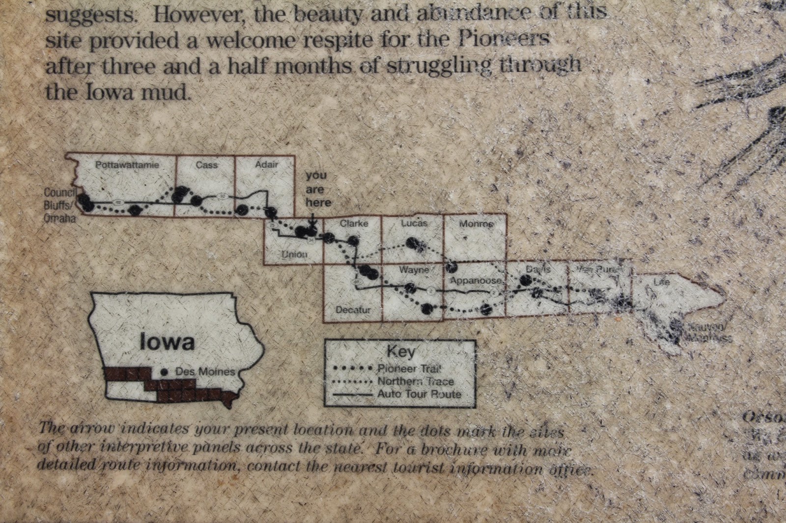
Saturday we left Nauvoo at about 2:00. We crossed the Mississippi at Fort Madison (we were happy to note that the toll is only for east bound traffic). We then headed west along Iowa state road 2 which follows very close to the route of the 1846 exodus from Nauvoo across southern Iowa to Council Bluffs and Winter Quarters.


First stop was Garden Grove--one of the stopping points along the route that became a permanent settlement to supply other Mormon wagon trains that followed.


The tall grass is where cabins were located.


The road west. During part of the drive the kids enjoyed watching a DVD of Field of Dreams while driving across Iowa--"if you build it [a baseball field in the corn fields of Iowa] he will come". We also enjoyed some tunes from The Music Man.


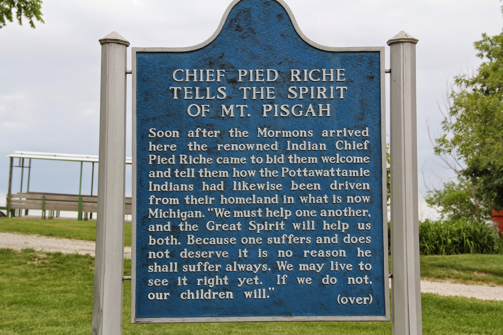
Further down the trail was another permanent supply stop called Mt. Pisgah.


The Mt. Pisgah monument to all those who died there.


The valley below "Mount" Pisgah where crops were grown.
 

17 year cicadas (magicicada) were everywhere at Mt. Pisgah.


The high pitched sound of the cicadas and their flying about did not please the kids.


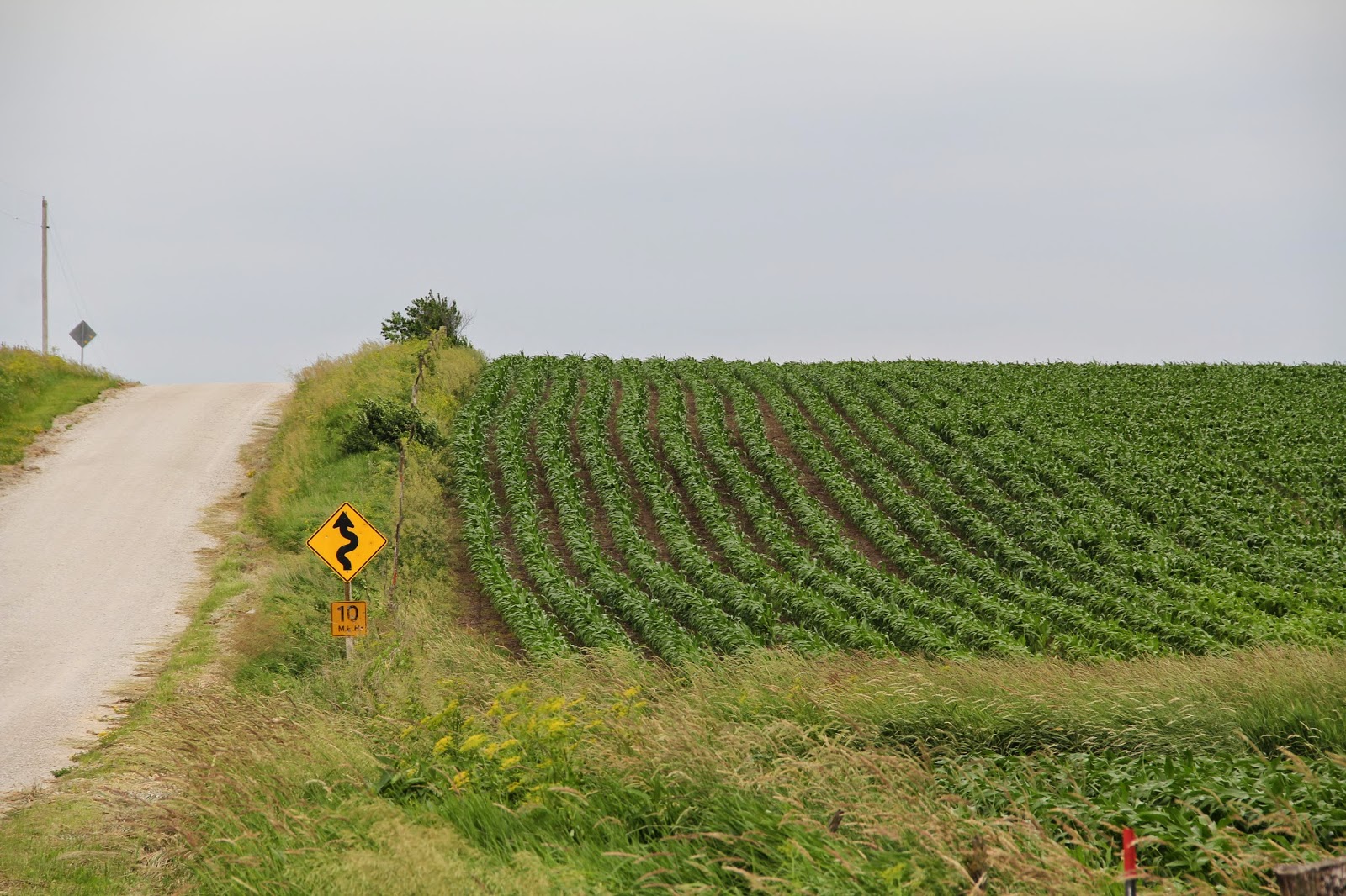
Our quest to follow the Mormon trail took us along several rural gravel roads in south central Iowa.


This side road (we didn't take) reminded me of what the wagon trail may have looked like. We stopped in Greenfield for Chinese food and then headed west to Council Bluff Iowa along highway 92. For most of the trip I had made previous hotel reservations, but for the final few days I was not sure of where we would be stopping. I figured we would us just drive until we found something. I figured wrong. We arrived in Council Bluffs at 9:00 pm only to find out that the College World Series had begun the day before in Omaha and that most every hotel room (we did find one smoking room, but that was vetoed) in the entire Omaha area and surrounding hinterland were full-up with partying baseball fans. Our plan was to attend church in Council Bluffs the next morning and then visit the Kanesville Tabernacle and Winter Quarters--two areas where the Mormons wintered over on their trek west. Since west to Omaha was full. I decided to head east as far as Minden on I-80 to see what we could find--nothing.


Meanwhile the kids kept entertained by taking selfies on my phone. We then headed north on I-29 to Missouri Valley, nothing. Then west on 30 to Blair and then Fremont, nothing. We headed further west and finally by 12:30 we found a place in Columbus--80 miles northwest from where we had hoped to be. None of us wanted to add three more hours to our next day's drive to go back to Council Bluffs and Winter Quarters so we opted to skip these LDS historical sites and go west. After such a late night we were happy to find that the Columbus Branch started at 10:00 am. We enjoyed the father's day oriented sacrament meeting. We then headed out along US 30 which fortuitously followed the Mormon Trail and Platte River.


Most cities we passed through had grain silos and a RR track.


In between were corn fields. Sandwiches at Subway for lunch in Grand Island and then for the rest of the day we followed the Platte River and the Mormon trail. Movie for this Sunday across Nebraska: 17 Miracles. Music: Mormon Tabernacle Choir.


The Platte River in western Nebraska.


Winter wheat fields in verdant Platte River Valley between Osh Kosh and Bridgewater. 


The railroad paralleled all of US 26 in western Nebraska. While driving this road we must have passed a dozen or more long trains. Those heading east were full of coal or petroleum. Those heading west (like this one) were returning empty for another load of coal.


For sure to be used in my geography of North America Lectures.


The Platte River valley with the tree lined river bank of the Platte in the far distance.


More coal heading east.


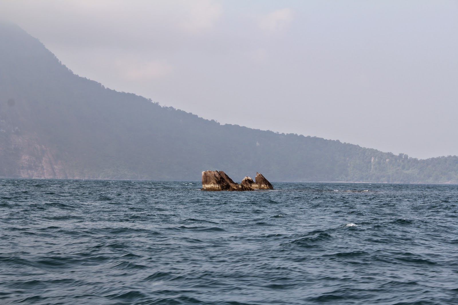
Chimney Rock. In all of my many drives across the great plains (vacations, driving to and from school and work in Chicago and DC) I have never gone this way. It was therefore exciting for me to following the Mormon/Oregon/California Trail and then like those pioneers to look out into the distance and see Chimney Rock. Cool.


This sign reminded me of my great-grandmother Agnes Caldwell Southworth who moved west along this route with the Wilie Handcart company. She was 9 years old and remembers her day with the rattle snakes. She relates: "One day we came to a section inhabited by rattle snakes. Two of us, my friend Mary Hurren and I, would hold hands and jump. It seemed to me we were jumping for more than a mile. Due to the protecting had of the Lord, we were not harmed." (The movie 17 Miracles includes this story).


Pioneer cemetery near Chimney Rock.


Scottsbluff.


We easily found a hotel in Torrington, Wyoming. Next morning we headed out earlier than usual (8:30 am) with the hope that we would make it to Springville that night, one day earlier than planned. We once again crossed the Platte River by car and then by food on this bridge.


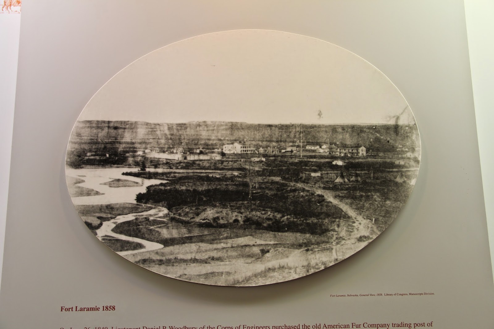
We then visited Fort Laramie (named from French trapper LaRemee who died in the area).


The original fort looked like a Disneyland Frontierland type fort/stockade I had envisioned. 


But by the time the Mormon Trail passed through here it was more like a town with no protective wall.


 The barracks.


Fort Laramie had a great location near the confluence of the Platte and Laramie Rivers. It first grew because of the fur trade, then the pioneer trail and finally Indian matters.


When emigrants and Indians came to trade at the Fort they camped across the Laramie River.


When the Wilie handcart company arrived at the fort, my great great grandmother Margaret McFall Caldwell and Christina McNeil, a single 24 year old woman traveling with the Caldwell family in the place of William (who had joined the Scottish Army), had this experience as related by Margaret's daughter Agnes: "Mother visited one of the generals in command at the fort to obtain permission to trade some trinkets and a silver spoon for flour and meat. The office said he himself could not use any of the things but to leave [Christina] in his office while mother went to another station, where he assured her she would be able to obtain the things she desired. He seemed very kind, and not wishing to arouse any feeling of ill will she left Christina and [her son] Thomas. During her absence, the office used the time in trying to persuade Christina to stay there, proposing to her and showing her the gold he had telling her what a fine lady he would make of her. Then he tried discouraging her, pointing out to her how the handcart company would never reach Utah, [that] they would all die of cold and hunger and exposure. Like all noble girls and true to the cause for which she had left her native Scotland...she told him in plain language she would take her chances with the others even tough it meant death. She was greatly relieved to have mother return. The office, however, seemed to admire her very much for her loyalty to her faith and gave her a large cured ham and wished her well in her chosen adventure."


It is not known if Margaret was able to make her trade, but if she did it might have allowed her to buy supplies in Sutler's store.


Margaret was a master at providing for her family. Her daughter Agnes remembers: “Winter came in October with eighteen inches of snow, but in spite of this we did not suffer from hunger, due to Mother’s careful and frugal planning. In Iowa City Mother sold a quilt and a bedspread for the sum of twenty-four cents. With this she bought food. She had a way with Indians: she traded trinkets for dried meat, which proved to be of great help to us on the journey. Frequently it would be stormy so that a fire could not be built; then mother would allow each of us to have a piece of dried meat on a piece of bread. As food became more and more scarce and the weather colder, she would stew a little of this meat and make a delicious gravy over it.”    

In remembering the journey, Margaret remembers that she “tried to be industrious, thrifty and, most of all, courageous.”  These qualities most likely saved her family. When early snows trapped the pioneers on the high plains of Wyoming, 68 of the 404 members in the company died of cold and starvation, none were from the Margaret Caldwell cart.   


We next stopped in Guernsey for a short hike up to see wagon ruts carved into the sandstone by the pioneer trails that all passed here.
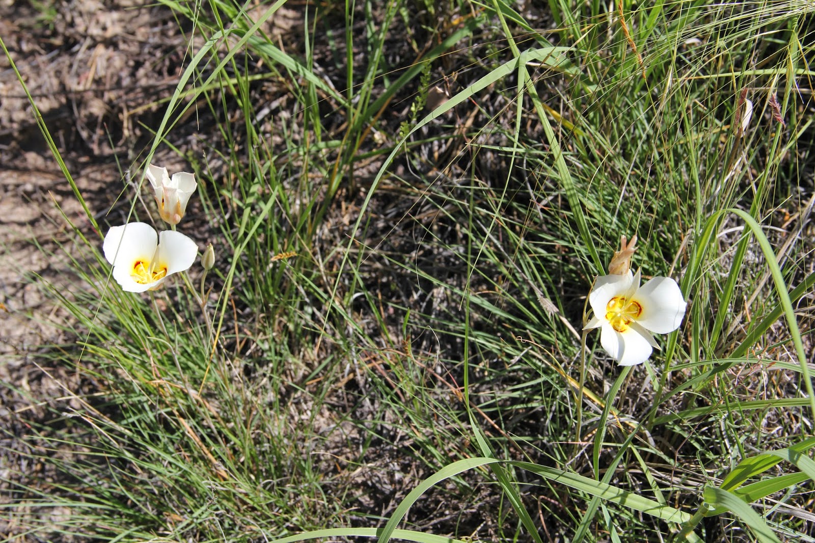


Sego Lillies, Utah state flower in eastern Wyoming.


We then followed the trail up northward around the Laramie Mountains. This is the first view of mountains from the trail. We ate a quick lunch at Hardees in Caspar and then continued to follow the Platte River for a short while then the pioneers jumped river basins to the Sweetwater River.


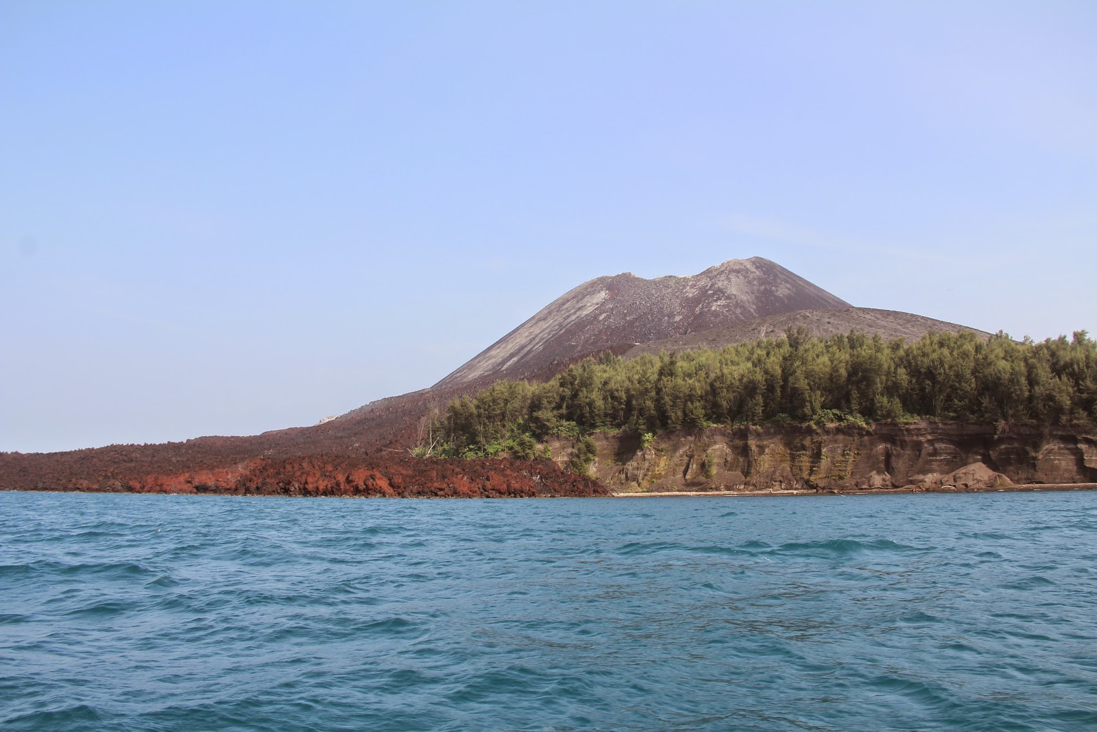
The trail passed by Independence Rock (which we climbed)


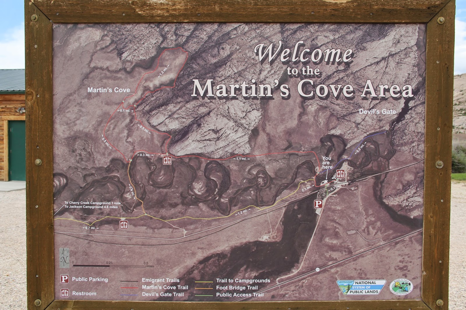
Looking west to Devil's gate and Martin's Cove.


Nice flag. The wonderful score to Dances With Wolves appropriately accompanied our drive across eastern Wyoming


Like the Willie and Martin handcart companies, we too were running late by the time we reached the Sweetwater. We learned a lot at the visitor center.


Until this drive along the whole Mormon Trail I had never realized how relatively flat the journey was up until South Pass and then the Wasatch Mountains. The Platte and Sweet Water river valleys provided a much easier route than up an over the Colorado Rockies as witnessed in our first days drive along I-70.


From a list of all the Wilie company members. Those who died are in yellow. Margaret Ann McFall Caldwell age 40 was a widow from Scotland. She and her four children set sail to America in 1856 and were members of the Willie Handcart Company that traveled westward late in the season to the Salt Lake Valley using cheaper and faster hand-pulled carts. Men were often the primary pullers of the handcarts, but for the Caldwell family it was a female endeavor. Unable to help were oldest son Robert (age 16) who was assigned to drive one of the supply wagons and Thomas (age 14) who broke his collar bone early on in the trek. That left Margaret and Christina, a young single woman traveling with the family, to pull the cart the full 1,300 miles across the Great Plains and Rocky Mountains. Helping push while the older women pulled were 11 year old Elizabeth and 9 year old Agnes.


We pulled and pushed a handcart a mile up to entrance of Martin's Cove.


Will Emmett and Agnes Caldwell were both nine when they pulled handcarts. There antics were sometimes similar. Agnes writes: "I can yet close my eyes and see everything in panoramic precision before me. The ceaseless walking, walking, ever to remain in my memory. Many times I would be come so tired, and childlike, would hang on the cart, only to be gently pushed away. Then I would throw myself by the side of the road and cry., Then realizing they were all passing me by, I would jump to my feet and make an extra run to catch up."


Buffalo chip gathering.


The Sweetwater River that had to be crossed nine times.


Martin's Cove.


A snake that crossed our path and startled Marie.


From Martin's Cove we drove about an hour westward to the sixth crossing of the Sweetwater. This is where the Wilie Company was when the snow fell.


Of the rescue further along the trial Agnes writes: “Just before we crossed the mountains, relief wagons reached us, and it certainly was a relief. The infirm and aged were allowed to ride, all able-bodied continuing to walk. When the wagons started out, a number of us children decided to see how long we could keep up with the wagons, in hopes of being asked to ride. At least that is what my great hope was. One by one they all fell out, until I was the last one remaining, so determined was I that I should get a ride. After what seemed the longest run I ever made before or since, the driver…called to me, “Say sissy, would you like a ride?” I answered in my very best manner, “Yes sir.” At this he reached over, taking my hand, clucking to his horses to make me run, with legs that seemed to me could run no farther. On we went, to what to me seemed miles. What went through my head at that time was that he was the meanest man that ever lived or that I had ever heard of, and other things that would not be a credit nor would it look well coming from one so young.  Just at what seemed the breaking point, he stopped. Taking a blanket, he wrapped me up and lay me in the bottom of the wagon, warm and comfortable. Here I had time to change my mind as I surely did knowing full well by doing this he saved me from freezing when taken into the wagon.” (Susan Arrington Madsen. I Walked to Zion, Deseret Book, 1994 and Andrew Olsen et al, Follow Me to Zion, Deseret Book, 2013).

We drove in three long days what it took Margaret, Agnes and many other of our ancestors months of walking and wagon riding to do. What faith they had. I am honored to be their descendant.


All along the trail for the past few days we read stories and accounts from these books. We used all six volumes of the Sacred Places guide books to Mormon History to help in our travels from Sharon to the Sweetwater. The maps really helped in following the Mormon Trail.


We then headed out for home. We had to drive along lonely Wyoming roads, including this one climbing up to South Pass. We stopped here for a post Gatorade break for the boys.


A few miles earlier I was pulled over for going too fast. Luckily the nice Wyoming HP officer took pity on me when I told him we were on the last day of a 3 1/2 week road trip and we were trying to get home to Springville Utah that night.  I think it also helped to have a wife and three kids in the car. I only got a warning.


Sunset half way between Lander and Rock Springs. We got to Rock Springs at 9:30 pm. Dinner at Wendy's (there's not much between Sixth Crossing and Rock Springs) and then pressed on. By 12:30 we were rounding Deer Creek reservoir when for the second time this day and for the second time on this trip I was pulled over for going too fast. The nice Wasatch County officer likewise took pity on a father at the end of a road trip just wanting to get everyone home to their own beds. It is a rare thing for me to get pulled over. It is also a rare thing to only get warnings twice in one day. We pulled in at 1:35 AM only to find that we were locked out (long story about how that came to be) and so when we couldn't find our hidden spare key I luckily was able to get a window pried open and climb in.


I want to thank Dr. Pepper (something I most often only drink when driving) and Trader Joe for food (these almonds are pretty yummy and spicy) and drink to help keep me awake on long drives. Thanks to Marie for keeping us fed, for getting laundry done on the fly and for begin my navigator (all this practice has been good preparation for when we are selected for the Amazing Race). Thanks to Sarah, Joel and Will for being such fun and pleasant travelers. I hope this road trip provides you with many happy and enriching memories. Thanks to the Pritchetts for the use of their road worthy van (and its express pass) that carried us 6,600 miles. Thanks to the Struves, Paksimas, Andersons, Deardens, and Krumpermans for sharing their homes with us and to Holiday Inn Expresses for the good breakfasts and fun pools.

Keyhole Canyon and Zion Narrows

$
0
0

When we started to plan our big road trip back east we had to find a three week slot somewhere between the Young Men's high adventure for me, Sarah's girls camp, Joel's scout camp, a nephew's wedding and my mid August trip to Indonesia.  To make it all work we ended up taking the kids out of the last week of school. We got back in town from our trip late Monday night which was just enough time to unpack, rest and and then head out on Thursday morning for Zion National Park. By the time the seven boys and six leaders arrived at about 1:00 all of the park campsites were full so we stayed an a RV/tent campground in Springdale. After setting up camp and having lunch we set out on our first big adventure. Ultra outdoors-man Barrett Raymond (lives a few houses down the street) was to be our guide. I wasn't around for much of the planning so all I knew about that hike was that it involved one medium rappel and two short rapples. No mention of it being a narrow slot canyon that would skin each appendage or that there were ice cold pools waiting at the bottom of the rappels. Perhaps it was good I didn't know all of the details. I may have bowed out give my increasing fear of heights and very limited experience rappelling. I'm very glad I pressed on.


Our "short" hike was a loop through Keyhole canyon just a mile up the road from the eastern exit/entrance of the MT. Carmel tunnel at Zion. 


The entrance to Keyhole Canyon is the narrow slot to the left of the big tree.


So far so good.


Oh no! Can I do this? Yes I can!


The first slot canyon section then opened up. Here we prepared for the first rappel.


First down is Tanner.


We had no idea what lay below.


Next up Garrett.


Then Cody.


Jackson.


Kaden, the newest Teacher and his first time rappeling. He did great.


Nick, then me. It was easier than I thought.


Down in the canyon.


Next comes neighbor Fred, retired, the ward executive secretary and a year and a half younger than me, which makes me the oldest person on the trip. 


Jaycen, who in one month leaves for his mission in Ohio. He made it look easy.


Bishop Frossard, who was my counselor and who then replaced me as bishop got a little twisted near the top and it was all downhead from there.


Still smiling.


Finally righted.


Jon Marshall, Young Men's president.


This short descent down the crevasse into the pool was without a rope. The water in the canyon never sees sun light so it is very cold.


Second rappel.


The young men slid down this section, but the AARP contingent used a rope which made it much easier.


There was limited space to wait while those up ahead were slowly navigating the tight canyon so Jaycen waited while straddling above a pool.


At one point Barrett realized that it was getting late and feared we may not make it out by dark. To hustle the leaders up he pulled out a flash light in the deepest, darkest part of the slot to help them better see their way.


Barrett leading the way. He and the boys made it look easy. I gradually started to get the hang of it, but in the process I scraped elbows, knees and knuckles as I pressed body parts (belly and butt included) against sandstone to hold me up. At one point Bishop Frossard got his foot caught in some rocks in the tight V-shaped bottom of the canyon. I was behind and above him and could not get past him to help. All I could do was to offer him my Swiss Army knife to cut off his foot. :) Luckily Jaycen came back to see what was holding us up and was able to help pull the bishop's foot out.


Light at the end of the tunnel.


Jon opted to stay in the slot to the end--which required a swim. Others of us took a short cut up and over.


The end of the slot.


The top course of Keyhole Canyon. The short hike took us about four hours. We could have done it much faster divided into two groups each with their own rope and with a few more experienced rock men to help Barrett guide, explain and support. I have always wanted to canyoneer down a slot canyon like this, but lacked the knowledge and ability to make it happen. This was a grand adventure for me.


Back at camp we cooked a late dinner and then enjoyed the warmth of the campground showers. When we checked in we were only allowed to stay for one night on a trial basis. The management had had too many bad experiences with Utah Scout troops who were noisy and bothersome late into the night, much to the frustration of campers from all over the world. Fortunately, after our little adventure, our boys had no energy to stay up late making noise. By 10:00 they were all in their tent and soon asleep. We passed the test. Next morning, we were given permission to stay one more night.


Day two was a hike up the Virgin River narrows.  I have hiked the whole length of the narrows once and gone up and back half way from the bottom twice. It is a favorite hike of mine.


Starting out. The boys were soon long gone. I chanced it and carried my Canon camera in my left hand the whole way up so that I could take photos. Luckily I never fell while walking in water atop large, wet rocks. What follows are a few of those photos in chronological order. Photos do not do it just.


Side trip up the more narrow Orderville Canyon, which feeds into the Virgin River Canyon about 1 1/2 hours up stream.


This side canyon had a few rocky obstacles.


Mike Black. I called him as scout master all most ten years ago. He now serves with me in the Teacher's Quroum. He is a very handy man to have on campouts.


Orderville Canyon


Back into the Virgin River Narrows.


In some places where it is just water and wall you pray that no flashfloods come your way. Thanks Will for letting me use your souvenir walking stick from Concord Massachusetts.


There is no place to escape. Walking the narrows is best done in early summer or fall, before and after summer monsoon season when flash floods are more likely.


Columbine


Finally met up with the Young Men and Barrett Raymond. They had made it up to Big Springs and were now heading back. It was our appointed turn around time so I followed.


Leaving the narrows.


Another good dinner (cooked by the boys). Two days of hiking tuckered them out. This is 9:00 Am the next morning when even the smell of cooking bacon did not roust them from their beds. I had hoped that for the third day of our "high adventure" we could add a hike up to Angel's Landing (another favorite hike of mine) to the preplanned itinerary, but even after two days of building it up and even noting that it was on Outside Magazine's list of top ten hikes in America, I couldn't get anyone to go. Extra sleep, a slow pack up and departure, and an early afternoon arrival back in Springville were preferred. Not to worry. I at least had two great days of adventure.


To see all 400+ photos go here: https://www.flickr.com/photos/79274436@N02/sets/72157644894668710/

The Israeli/Palestinian Conflict: My View

$
0
0


As I sit at my desk wearing my souvenir t-shirt from the Benjamin Franklin Museum in Philadelphia emboldened with Franklin’s statement “There never was a good war or a bad peace” my thoughts turn to the Middle East where for my whole life (I was born in 1956 the year of the second Arab-Israeli War) there have been wars and rumors of wars. These wars foster a wide array of feelings and opinions. What follows is a personal narrative of my view of the ongoing conflict between Palestinians and Israelis. I write it in hopes that it might help others better understand the conflict and its complexities. 

I grew up in a time when most Americans and most Mormons saw the establishment of the state of Israel as the fulfillment of biblical prophecy. They also saw continued support for Israel as a key component of US foreign policy in a cold war era (and then later in our war against radical Islam). These views were justified and sustained by what we watched on the evening news, read in our daily newspapers and heard from our politicians. 

On a more local, personal level, I remember Sunday School and Seminary lessons about the signs of the times and the return of the Jews, of “sticks” of Joseph and Judah coming together, and of familial Israelite ties between Jews and Mormons. I remember being aware of a pro-Israel LDS book entitled Fantastic Victory about Israel’s victory in the June 67 Six-day war. I also remember reading many interesting books about Jews, Judaism, the Holocaust and Israel including: Exodus, Mila 18, The Chosen, The Promise, The Source, The Winds of War, War and Remembrance etc. These experiences instilled within me a love and interest in Judaism, Jews and Israel. 

Then my world view broadened and began to evolve. I was sent on a LDS mission to Indonesia, the largest Muslim country in the world. There I came to learn about many similar views and beliefs shared between Mormons and Muslims. I no longer perceived Muslims as solely the antagonists of Israel, but rather as real people who loved God and others. I started studying Arabic (because of my on-going interest in the Middle East and because of the influence of Arabic on Indonesian). I traveled to Israel for three weeks after graduating from USU.  I went to BYU and got a Master’s degree in International Relations and Middle East Studies. I interned in DC with the National Association of Arab Americans. I participated in the BYU Jerusalem Study Abroad in 1982 where I did research for my master’s thesis entitled: “An Attitude Survey of BYU Jerusalem Students towards the Arab-Israeli conflict.” I lived in Nazareth for a year (1988-89, during the height of the intifada) doing research for my dissertation. I studied more Arabic and more about the Middle East while earning my PhD in Geography from the University of Chicago. I have researched and taught at the university level about the Middle East and more specifically the Israeli-Palestinian conflict for 24 years. I taught Old and New Testament classes at the BYU Jerusalem Center for three semesters, 2009-2010.

Through these many years I have come to see the conflict in many shades of grey. The black and white of my childhood--Israel good, Arabs bad--is long gone.  Nothing is simple. A common feeling throughout the years has been one of confusion. Some days I get mad at the stubborn Israelis, other days I get mad at the stubborn Palestinians. Why can’t they compromise? Some days I sympathize with Israel’s demand for security and its need to defend itself, but then on other days my anger swells when bombs fall on children playing on the beach in Gaza, when Palestinian friends are left trapped in the walled ghetto of Bethlehem, when Palestinian land is expropriated and built upon, when justice does not “roll down like waters” (Amos 5:24). Conversely, I support Palestinian demands for something better (independence or equality) and yet cannot support methods of terrorism in the form of missiles and suicide bombers that target non-combatants. I sorrow for both sides where death often comes too soon and where everyday life is never easy and never without extra concern or burden. 


Jews and Arabs in Hebron 1995

Here are some things I have come to realize over the years. 1) There is no right or wrong side in this conflict. Both sides have valid claims to living in the land. Both sides have done bad things. 2) Trying to justify the territorial/nationalistic/religious claims of one group over the other or blaming one side over the other will never work. For every rocket launched, wall constructed, bomb detonated, home demolished, permit denied, or bullet shot, there is another side, another story, another reason, and another time and place where the other side did something equally atrocious.  3) There will never be peace until both sides agree to somehow share the land. Neither group is going to pack up and leave. 4) Israel will never have peace until Palestinians have a state or equality. Peace does not come through strength, or walls, or better missiles and military. It comes through sharing and understanding and working together. If Gazans had any hope at all for something good in their future they would be much less inclined to turn toward terrorism. Having a job, a safe home, and well fed kids is a much greater incentive to live in peace with your neighbor than the dropping of bigger bombs. 5) Radical Islam (Hamas in Gaza and al-Qaeda and others elsewhere) has and will continue to fester and bring more suffering and sorrow to innocent people in Gaza, in Israel and throughout the Middle East and the world (one of al-Qaeda's on-going grievances is the Israeli occupation of Arab lands) as long as Israel and the Palestinians are at odds and the West (ie US) is viewed as being biased in the conflict. 6) There is always hope and there are good people on both sides doing good things. For example attorney Danny Seideman an Israeli Jew born and raised in the United States has established a legal foundation called  Ir-Amin that uses the Israeli legal system to defend the housing rights of Arabs in East Jerusalem http://www.ir-amim.org.il/en/node/220. He also regularly escorts BYU Jerusalem students on a compelling tour in which he shares his dream of a shared and peaceful Jerusalem. Sahar Qumsiyeh is a Palestinian Mormon from Beit Sahour who tells an uplifting story of how she learned to love her enemy http://www.mormonwomen.com/2010/11/17/peace-through-conflict/.

From a LDS perspective here are some other things I have come to realize: The land was and is a covenant land that was promised to Abraham and his descendants contingent up their following God and keeping His commandants (Genesis 17:1-8, Abraham 2: 6-10). Arabs, via Ishmael and Esau, and Jews via Isaac and Jacob are those descendants. Mormon Church President Howard W. Hunter referred to both of these people as “children of promise” and stressed that “as a church we do not take sides” (All Are Alike Unto God, BYU devotional 1979). Over time Abraham’s posterity slowly turned from the covenant and lost their heavenly right to live in the land. Esau sold his birthright and married out of the covenant. The idolatrous northern ten tribes were “spewed out of the land” by the Assyrians as first warned by Moses (Leviticus 18:24-28, see also 1 Nephi 17:33-35). A century later Israelite inhabitants of the southern kingdom of Judah who persecuted the prophets and turned from God were likewise removed from the land by the Babylonians. Jews were once again exiled from the land in 70 AD by the Romans. 

Which of Abraham’s descendants will re-inherit the land and when that will happen seems to be a complicated, ongoing process. The Arabs of Abraham’s fold (through Esau and Ishmael) have lived in East Mediterranean lands for thousands of years. Additionally, many of the Arab Palestinian Christians are descendants of the first converts to Christ. This means that they were most likely Jewish converts. Some of these early Christians later converted to Islam further mixing the “blood of Israel.” To me this means that the modern day Palestinian Arabs more likely than not have claim to the promises of Abraham through both branches of the Abrahamic family. 

Complicating the matter are the many prophecies of Judah returning to the land (Isaiah 11: 11-12; 2 Nephi 9:2). That return is certainly happening, but must it happen at the expense and even expulsion of other Abrahamic peoples who have remained in the land? More importantly, that return to re-inherit the promised land is conditional. In multiple places in the scriptures we are taught that that return is contingent upon a time when Israel (the people) “shall have one shepherd” and “they all shall also walk in [his] judgments, and observe [his] statutes,” (Ezekiel 37: 21-28). More specifically, the Book of Mormon explains: “When the day cometh that they [the Jews] shall believe in me, that I am Christ, then have I covenanted with their fathers that they shall be restored in the flesh, upon the earth, unto the lands of their inheritance” (2 Nephi 10: 5-8, see also 2 Nephi 6:9-11, 3 Nephi 29-33). That day is not yet here. 

 Central Park Protest, June 2014.

Interestingly, there are some factions within Orthodox Judaism who do not recognize the establishment of a political state for Jews. They believe that such a state much be a religious state in terms of Jewish belief and practice and not just in terms of Jewish ethnicity and nationality. 

So what is to be done with this one land, claimed by two nations (Palestinian and Israeli) and deemed holy by three religions?

One option is for Israel to continue to maintain its control over of all of the land while ignoring the fact that this “lone democracy in the Middle East” is denying democratic rights to millions of people. In doing so it would continue to support an apartheid-like regime in the West Bank where there now exist separate road networks, car license plates, economies, schools and communities. Palestinians would continue to live in misery, frustration and anger while Israelis would continue to live in daily fear of more suicide bombers and missiles. To me, this is not an option. Something has to change. 

Another unacceptable solution is that of the extremists on both sides who seek for an ethnically cleansed land, a single state just for Jews or just for Palestinians. Their methods are atrocious. There are Israelis who have put bombs under the gas peddles of Palestinian mayors and have entered mosques and killed dozens at prayer with a machine gun. Similarly there are Palestinians who have detonated themselves on buses, in wedding halls and in restaurants, and who have run amok with knives and tractors. Simply put, people on both sides, from the the time of the British Mandate until now, have resorted to terrorist acts that have killed too many innocent civilians.

Sometimes the methods used to solidify single control of the land are more subtle. The state of Israel, for example has for decades demolished thousands of homes because they were built without permits when permits were long denied and as punishment to families suspected of having a child who has engaged in acts of resistance. The state has also implemented policies that make it very hard for Palestinians to hold on to their land, to build new homes, and to travel freely (Palestinian women have given birth at Israeli controlled checkpoints where young soldiers, for whatever reason, refuse these women passage to a hospital). The underlying hope always seems to be that if life for Palestinians gets to be too hard they will go elsewhere. No one is killed in these acts, but like traditional terrorism, these acts serve to unsettle, upset and terrorize people.

Additionally, Israeli policies make it very difficult to obtain residency permits to live in the many different jurisdictions under Israeli control. I know of a BYU graduate who is a Palestinian resident of East Jerusalem. He works in the West Bank town of Ramallah. Several years ago when he was trying to find a wife he explained how challenging it was. If he ever wanted to marry a Palestinian from the West Bank, she would not be permitted to move into his family home in East Jerusalem. He would have to move to the West Bank. Their children would then not have East Jerusalem residency which would mean it would be difficult to go visit their paternal grandparents. A Palestinian LDS family living in Bethlehem that I know has to deal with these ludicrous permits all the time. The mother has East Jerusalem residency but her husband does not. She teaches at an Arab school in Jerusalem and has the necessary permit to cross through the security wall every day for work. He cannot enter Jerusalem (even to attend church services), except by special, hard-to-obtain one time permits. In order that the couple’s three children have the same rights as their mother, they have had to be born in East Jerusalem, sometimes without the father being able to attend the birth of his child. 


Even with their lives disrupted and terrorized, the majority of Palestinians and Israelis are not going anywhere. They choose to remain entwined in a land where they seldom interact. The very reality of this intertwining of Israelis and Palestinians, both within Israel where Palestinian Arabs who are Israeli citizens make up 20 percent of the population and in the West Bank and East Jerusalem where Israeli built “settlements” exist side-by-side with Palestinian neighborhoods and villages, has led many to come to the conclusion that the only possible solution now is a one state solution. The “facts on the ground” make partition next to impossible. There is no going back. In theory this sounds like a wonderful idea. Establish a secular democratic state in the land of Israel/Palestine in which all peoples of the land—whether they think of themselves as Israeli, Palestinian, Arab, Jew, Muslim, Christian, or Druze—are equal citizens. Unfortunately, there are two main drawbacks to this otherwise great idea. First, Israel would have to cease existing as a “Jewish State.” This means that there would no longer be one country in a world where the Holocaust happened and antisemitism is still a reality that ensures Jews will always have their own place to protect them. The loss of a state in which Jews are the majority and the unchallenged rulers would be a hard thing for Israeli Jews to accept. Second, the intense animosity between the two groups may need a generation or two of peace and cooperation before they are willing to govern together. 

The most practical solution thus seems to be the long espoused two-state solution, first proposed by the British in 1937 when they realized that the conflict was one of “right against right” and then as part of the proposed 1947 UN Partition plan. The UN plan, with its fragmented states, was accepted by the Jews who had no other place to go after WWII. The Palestinian Arabs on the other hand refused the offer (hindsight says they should have accepted it) thinking it wasn’t fair that over half of their land be given to another people (who only made up 1/3 of the population and owned only 7-12 % of the land) to assuage the world’s guilt for not having done more to protect Europe’s Jews and to hasten the fulfillment of biblical prophecies. The plan proposed the creation of a Jewish state on 56% of the land, including the Huleh Valley, Jezreel Valley and coastal plain where many Jews had settled in the previous 50 years and the sparsely populated arid Negev in the south. Included in that state were about 500,000 Arabs (in cities like Jaffa, Haifa and Tiberius) who would then make up 45% of the Jewish state. The Arab state included the Arab populated hills of Galilee, Samaria and Judea as well as Gaza. This state was over 98% Arab. The mixed city of Jerusalem was to become an international zone. 

The Arab rejection of this unfair plan led to the first Arab-Israeli war. That war sent 700,000 Palestinian refugees fleeing into neighboring countries and facilitated an expansion of the Jewish State (including the Arab Galilee) to include 78% of historic Palestine. That state of Israel expanded even further with territories conquered in the Six-day War (when Israel launched a preemptive strike against Egypt and Syria). Of those territories, Israel gave back the Sinai to make peace with Egypt, it annexed the strategic Golan Heights (which Syria still claims) and sacred East Jerusalem, and left the West Bank and Gaza in territorial limbo, under Israeli control but without citizenship or rights. Israel has long feared annexation of these populous territories. If annexed, then “democratic” Israel would have to grant citizenship and the right to vote. The higher birth rate of Palestinians over Israelis means that there are now almost equal numbers of Jews and Arab in Israel/Palestine and that soon Arabs will be the majority. This fear of being out-numbered is what has compelled many Israelis to embrace a two-state solution so that a Jewish majority state might remain. Other Israelis reject a two-state solution wanting to hold on to the West Bank for its historical/religious sites (tomb of the patriarchs in Hebron, Rachel’s tomb in Bethlehem, Shiloh, Shechem, Bethel etc.) so central to Jewish heritage and located in the heart of the promised land, for its vital aquifers, and for its strategic highlands that look down on Israel’s narrow coastal plain. Interestingly, in 1947 Palestinians rejected partition because they were on top in terms of population and land holdings while the beleaguered Jews were willing to accept whatever was offered.  Nowadays, it is the Israelis who have little desire to compromise or share, while the under-dog Palestinians are willing to accept partition. 

The most obvious way to partition the land into two states is to return to the 1948-1967 cease-fire line. Most Palestinians would willingly accept an independent state of Palestine that encompassed East Jerusalem, the West Bank and Gaza (if Hamas in Gaza and Fatah in the West Bank prove unable to work together then there may need to be a three-state solution consisting of Israel and  two small Palestinian states). To get to that point there are a few points of contention. First, what to do with the wall and the border?  In the name of security the wall gerrymanders deep into the West Bank to include as many Israeli settlements as possible (the original intent of these settlements was to solidify Israeli control over the occupied territories, but in a shift towards a two state solution they have now become impediments to peace). If the wall had been built along the green line of the 67 border then the wall would be a fitting border, but in its current route it serves as an Israeli land grab that also cuts Palestinian cities off from their hinterland and farmers off from their fields. What to do with all of the Israeli settlements in the West Bank? They could be vacated and dismantled as were the settlements in Gaza, Israeli settlers could remain and become Jewish citizens of Palestine or they could be vacated and then offered to returning Palestinians refugees. Some settlements close to the 67 border could be allowed to remain a part of Israel if equal amounts of border lands in other areas are offered in exchange to Palestine.  


The most obvious stumbling block is Jerusalem—that “burdensome stone” of the last days (Zechariah 12:3). Neither side wants to give up this sacred city, particularly the Temple Mount/Noble Sanctuary (Haram al-Sharif). Options include partitioning the city once again, maintaining the status quo of Israeli control, or making it an international city jointly controlled and enjoyed  by its many religious communities. I like the international option, but it would be a very hard thing for Israel to give up its control of the Temple Mount. One other option (which I wrote about in 1997 in an article in the Journal of Palestine Studies) that I personally like is to make Jerusalem a shared capital of two states--Israel and Palestine. If ever asked to broker a peace, this is what I would work toward. Read more here: http://www.jstor.org/stable/2537780.  The see how Israelis are gradually encroaching into Palestinian neighborhoods to solidify Israeli control over all of Jerusalem read this blog post: http://beitemmett.blogspot.com/2010/02/east-jerusalem-settlements.html

In summary, the state of Israel is here to stay and Palestinians are here to stay. Israelis and Palestinians have to share the land. There is no other humane way. If the two parties cannot work it out (which does not seem likely), then the rest of the world may need to help. That help may come in the form of economic aid to build infrastructure and institutions in Palestine (something the US is already doing), writing a senator or congressman to encourage fairness, supporting economic pressure in the form of boycotts, divestment and sanctions against Israel (http://www.bdsmovement), providing negotiation help in working through the hard issues of Jerusalem and right of return (or compensation) for Palestinian refugees, offering economic compensation for Jewish settlers who vacate their West Bank homes, and continued vigilance in routing out  religious and nationalist extremism.

At the very least, we can all seek to be “peacemakers” (Matthew 5:9) and we can “pray for the peace of Jerusalem” (Psalm 122:6).

_____________
I am not Israeli or Palestinian. I cannot begin to fathom the complexity and conflict of what they feel. What I feel is based on my own experiences and my own study. Here is a series of photos that I have taken over the years that help to explain why I feel the way I do.


North and east of central Jerusalem are the Jewish settlements of NeveYaacov and PigatZeev. They neighbor the Arab village of Hizma. Over the years I have visited this area and have taken photos to show some changes in the landscape.
Here is a 1989 photo of NeveYaacov  (distance) and PigatZeev where my Aunt and Uncle lived while he was director of the BYU Jerusalem Center. Notice all of the construction that is going on.
Down below Pisgat Ze'ev on the outskirts of Hizma I met an Arab family one morning while out jogging. Their son got married and they tired to get permission from the Jerusalem municipal government to add two rooms to their two room house for the newlywed couple to live in. Permission was denied. The family went ahead and built the addition.
 The Israeli government then came in and bulldozed downthe addition. Meanwhile up on the hill the construction of homes for Israeli settlers continued.
From the front yard of that Arab home I took this photo looking westward--the East Jerusalem neighborhood of Beit Hanina is just over the crest of the hill. The hill was being terraced for more Israeli homes.
I returned in 1995 to the same place and in six years the whole hillside was covered in new homes subsidized by the Israeli government.  The home of the Arab family I met which stood in the open space at the center of the photo was demolished. Two other Arab homes remained. This was all being done at a time when Israel and the Palestinians were engaged in intense peace negotiations centered in Oslo. Acts like this made Palestinians wonder how committed Israel really was towards peace.
By 1997 dozens of Israeli villas had popped up
By 2008 the two Arab homes on the outskirts of Hizma are enveloped by Israeli homes.
Additional Israeli housing creeps eastward onto more Arab lands.
Turning and looking toward the east you can see the wall that now separatesHizma from the two Arab homes and from the ever growing Israeli East Jerusalem settlements. If it was my home being demolished or my land being expropriated or my travel being cut off by the wall I don't think I would be very happy.

Pioneer Day at the children's rodeo in Wallsburg Utah

$
0
0


We weren't quite sure what we were going to do to celebrate Pioneer Day (July 24th is a state holiday in Utah in commemoration of the day Brigham Young and his band of pioneers arrived in the Salt Lake Valley in 1847). Hikes and parades were quickly vetoed by some younger members of the family. Then Uncle Lant called and invited us to join him at the Wallsburg children's rodeo. He and his wife had attended last year during their first summer in their new Provo Canyon home at the invitation of ward members from Wallsburg. The Pritchett's home places them in the Wallsburg LDS ward--about 10 miles away on the other side of Deer Creek reservoir. Wallsburg is a tiny farming town in the center of a small dead-end valley. The road in from Deer Creek dead-ends in town. Earlier in the week Uncle Lant hosted some east coast colleagues in his home to work on a research project. He tried to convince them to stay one extra day to attend the rodeo. He said these colleagues travel the world over to see exotic cultures and this rodeo, he said, was a good slice of exotic, rural, western, American culture. Lant was right.


First event was goat roping. The bleating goat was tethered by rope to a post. The kids rode down and then had to grab the goat and tie three legs together.  Years ago one of the Wallsburg families adopted five brothers from Guinea in West Africa. These boys have been raised just like all the other kids in Wallsburg, as ranchers and cowboys.


Next up barrel racing: circle three barrels and then race back.


The third event was hide riding. One person drags a mat (originally a cow hide) along behind the horse. Then the youth jumps on the passing hide and rides it through the dust back to the finish line. Some kids were smart and wore goggles, ATV helmets, stocking caps and other protective gear.


Then there was the chicken and rabbit race. First the young kids scoured the arena for scared-to-death chickens and rabbits. What ever they caught they could keep. Then the older kids did the same, Will almost got brave enough to join in but then "chickened" out (Joel and Will are on a pun kick). He was only willing to consider joining in with the mostly local crown because I told him he could keep any rabbit he caught. His follow up question was whether or not his mother would agree. I said that since she wasn't there (she was working on a wedding present quilt) she could not veto dad.


Next was "man on a barrel" in which a boy or girl stands on a barrel and then a rider comes and rescues them by having the person on the barrel jump on the back of the horse.


This was the winning/fastest pair. A father with his brave young daughter who he just grabbed off the barrel and carried to the finish line. 


This daughter took a leap and nearly flew off the other side almost dragging her dad with her, but she and he held on and she then swung back onto the horse.


It was during this event the Lant noted (what I had also been noticing) how equally involved girls were in all the events as compared to years ago when rodeo was mostly a man thing. Women did barrel racing but that was about it. In tiny, rural Wallsburg of today, girls roped goats, chased chickens, slid on hides, and leaped from barrels with the best of the boys and no one batted an eye. No one said girls shouldn't be doing that or can't be doing that. It seemed as natural as can be. It was also as natural as can be to cheer on black brothers born in Africa. Things are a changing. Who know what other changes as in store?


Happy cousins eating snow cones.


The final event was musical chairs in which men ride down around a barrel  and then back where they have to grab a seat on a chair (standard issue folding chairs from the local LDS chapel) while holding on to the reins of their horse. The one who doesn't get seated loses.


We continued our celebration at the Pritchett's community pool. Then that evening we joined with many neighbors at the annual "Fire and Ice" celebration in which we all eat homemade ice cream and watch fireworks. A fun day.

Ogden Temple

$
0
0

Today we had a enjoyable outing to the open house (all people including non-Mormons are welcome to visit) of the newly remodeled Ogden LDS Temple. Marie was home sick, but joining us were grandma Emmett and Aunt Betsy and cousins Eli and Luci.


I took limited photos because my primary focus was helping mom, who is not as steady on her feet as she once was. We took her photo in the shade so she could escape the heat of the late morning sun. We were all later revived with a delicious lunch at Zupas.


Adjacent to the temple is the Ogden tabernacle (used for Sunday stake conferences) which was built in 1956. It lost its steeple in the renovation project, I guess so it wouldn't compete with the temple steeple.

For wonderful photos of the interior (where photography was not allowed) please go to this site:

http://www.mormonnewsroom.org/article/public-invited-to-tour-newly-remodeled-ogden-utah-temple


The detail in the windows, carved carpeting, carved marble and woodwork often included a desert rose motif as in "the desert shall blossom as a rose."


Complementing the main color of whites and gold were many different shades of light teal/sage/mint. This is one of the marriage/sealing rooms where couples kneel at the alter to be married.


The peaceful Celestial Room is symbolic of our heavenly home where untied eternal families will live. One of my favorite parts of the temple was the the wonderful central dome.  Most celestial rooms seem to focus on a large central chandelier.


I also really like all of the original art work found throughout the hallways, offices, rooms and entry ways. These paintings often show local landscapes and people or new paintings of Jesus. Some offices were decorated with paintings of apple harvesting or hollyhocks. My favorite painting, which I found most encouraging of an ever progressing church, depicted a side profile of a woman of African heritage, dressed in white and kneeling in prayer. I hope it will one day be published so more people can enjoy it.

http://www.mormonnewsroom.org/multimedia-download/article/ogden-temple-to-get-architectural-facelift

These photos from the LDS Church show the original temple (which is just like the Provo Temple) and tabernacle (circa 1975) followed by the planned (and now completed) temple "facelilft" and de-steepled tabernacle.


Sweet and sixteen

$
0
0
Sarah planned a wonderful 16th birthday party. She and her mom (with a little help from the males in the house) executed her plans wonderfully. It was afternoon tea (actually raspberry lemonade) in which she and her four guests made their own hats and then enjoyed back yard dining of cucumber (from our garden) sandwiches, berry tarts, sliced vegetables and zucchini (from our garden) bread. The piece de resistance was the four layer from scratch chocolate cake with fresh strawberry/cream cheese frosting (Marie out did herself on this one).


The grandparents came to watch the falderal. Thanks to Grandma Tueller for the wonderful tea cups and tea pot.


Joel was the butler who greeted the guests at the door and then served the food (until he had to go to soccer practice).


So glad that Sarah came into our lives 16 years ago. She is delightful.

Jakarta

$
0
0

The Jakarta welcome (selamat datang) statue


Obvious inequalities.

I spent most of Thursday at the church office building at Jalan Senopati. I had a long list of follow up questions for Subandriyo for parts of my book already written. We then spent quite a bit of time talking about how the Mormon Church has gradually become better accepted in Indonesia. I will use some of his ideas in my conference presentation in Bandung. This information will also be used in my book. One think that Subandriyo has championed is having the Church reach out to other communities to build friendship and bridges. He gave me a t-shirt to illustrate his point. These shirts were worn in Central Java where the youth wing of NU (the largest Islamic organization in Indonesia) and Mormons joined forces in post-Merapi eruption rebuilding of latrines and water systems.


Friday I visited the national museum. Never been there before. A few highlights:


Portuguese territorial marker


Portuguese cannons called Mariam after Santa Maria who Portuguese sailors prayed to for protection in battle.


Many Buddhist and Hindu carvings.


The coming of many different religions plus pottery from Vietnam, China, Thailand and Burma are indicative of Indonesia as a corssroads.


Models of the varried houses of the archipelago.


My favorite Hindu diety.


One of many ancestor statues. Offerings for protection and blessings are still made to such images in many areas of Indonesia.


Statue of the last king of the Island of Lombok who was imprisoned by the Dutch for resisting in battle their rule.


Javanese gamelan.


The ceremonial bedroom of Dewi Swi, the goddess of rice. Rice was stored over night in bedrooms like this prior to it being used as an offering to Dewi Sri as a sign of thanks and a hope for continued blessings.


Large map of Indonesia's many ethnic groups.


Before I had time to see the exhibits in the modern wing, the museum closed early for Friday prayers. Good thing it did. I was then able to happen upon a passing protest parade challenging the recent results of the presidential elections in which rising star Jakarta Governor Jokowi won narrowly over old guard Prabowo, former general and ex-son-in-law of president Suharto.


Groups of soldiers, unions and others were bussed in to protest in front of the Constitution Court.


There were police and soliders on guard just in case something happened, but it turned out to be a peaceful affair. After, and even during the rally, groups would split off to go and eat boxed lunches. One groups had an extra lunch (curried ramen noodles and boiled egg) so they invited me to sit down on the sidewalk and join them. We had a good visit about politics and then about religion with a few others.


One of my lunch buddies.


 Post protest happiness.


I then visited (also another first for me)  the top of the national monument (Monas). Built by non-aligned President Sukarno to be taller than the Washington Monument.


The view south.


The US Embassy sits just south of Taman Merdeka (Independence Square) which surrounds Monas.

The view to the west. The large pool is for the now defunct nightly showing of a sound, water and light show. We used to visit the dancing water show as missioaries in hopes of meeting families willing to have us come and visit them.


The view north to the port the old dutch part of town.


To the Northwest is the Istiqlal mosque (the largest mosque in SE Asia and the neighboring Dutch built Catholic cathedral.


Eastward view.


These tourists from Sumatra ask to have their photo taken with me. I took their photo in return.


Waiting in line to go down the elevator.


There is a museum in the base of Monas with several dozen diorams about Indonesia history. This one is of Kartini teaching school. She was the daughter of a nobelman who advocated education for girls back in the late 1800s.


Building Borobudur


The "act of free choice" whereby less that 1,000 elite of Papua (under great pressure from the Indonesian military who had forced the Dutch out) voted to join Indonesia.


Two of the dioramas showed how local Protestants and Catholics supported the nationalist movement.


Later that day I met up again with Subandriyo at the office of former foreign minister and good friend of the LDS Church Alwi Shihab. One of his assistants is Iksan whose wife Rumtini came to BYu for her PhD in education. At that time their son Ilham was just a young boy. It was good to see them again.


With two men, one Muslim, one Mormon who both have a vision of an Indonesia where religion is not a divisive issue. Alwi Shihab once gae a wonderful devotional at BYU. He preaches Muslim-Christian friendship and cooperation. I hope Jokowi, who he has advised, asks him to be the minster of religion.


After the meeting I rode on the back of Subandriyo's motor cycle in and out of the car crowded streets of Jakarta to thier house for nice dinner of Indonesian favorites.


Saturday morning I rode the busway (computer bus with a designated lane) to visit the Istiqlal mosque and national cathedral. Many of the buses are elongated and there is a non required separation of the sexes. Women always sit and stand up front. Lots of hand phones in use.


This do not sign suggests whay it is the women stay away from men. Do not smoke, do not eat or drink, do not touch women.


Bought sdome more manggis (left) and salak (right)


The mosque was being used by 1,000 visiting lurah (district heads) who were being taught by teh Imam of the mosque.


Allah = God (for both Muslims and Christians)


W


Breaking the chains of occupation in celebration of Papua joining Indonesia.


The Ministry of Religion that had caused a lot of grief for Mormon missionaries trying to get visas. 


Diponogoro, independence leader against the Dutch.


Lots of guards with nothing to do.


Went into the fancy Indonesia Plaza mall to exchange money and happened upon this store. Too bad Joel and Will weren't with me and too bad they didn't bring lots of money.


Saturday evening I guest taught the institute class using slides from our church history road trip (they are studying Church History this year). I also introduced them, via stories and photos, to some of the early pioneers of the LDS Church in Indonesia. It was a fun evening. Before that I went to dinner with Juswan and Aischa Tandiman and two of their daughters.

Bogor

$
0
0

A delightful Sunday in Bogor. I served in Bogor for several months (including the July Bicentennial in 1976). Back then the LDS branch met in a large house. Over a decade ago, the Mormon Church was able to get approval from enough neighbors (as required by law) and the local community leaders to build this chapel.


I took this photo about 10 minutes before the start of the 9:00 sacrament meeting.


In my calling with the Young Men in our ward (I was recently released) I often wondered how members in countries where internet access is not common in homes are able to access and preapre the weekly on-line youth classes. I now know. Leaders in Indonesia get a printed version of "Follow Me" that is only accessible on-line to teachers in the US.


It was Indonesian Independence Day so for the rest song we sang the national anthem (one verse) Indonesia Raya. The speakers were assigned a very appropriate verse from Galatians 5:1 which states: "Stand fast therefore in the liberty wherewith Christ hath made us free, and be not entangled again with the yoke of bondage." This prompted three very good talks about the liberty that comes through following Jesus. A nice change from occasional July talks in American wards the focus more on very American topics such as the divine founding of America and its divine constitution. Prior to these three speakers, three missionaries were invited to bear their testimony. First up a just returned missionary from the Bogor Ward who apparently is now much more vocal than he was before he left. Second, a brand new 18 year old missionary from Idaho at his first ever meeting in Indonesia--he did quite well with the language. And finally me, a missionary from 38 years ago. I humored them with a story of dumping dozens of frogs in frog phobic Elder deJager's room, of having to play All Creatures of our God and King on the pump organ at break neck speeds because Branch President Siregar had been told by an expat leader that Indonesians sing too slow--I then thanked the two talented ward pianists who played in the meeting, and of having to spontaneously have to teach primary one day. I had the 8 children draw pictures of what they were thankful for. I too drew. It was a picture of all eight kids' faces. I then told them that I was thankful for them. Many of those primary children were in the meeting that day as parents and leaders. I expressed gratitude to see so many familiar faces from long ago.


One of the children still too young to be in primary that day was Thomas Siregar, former bishop of the ward. His wife Anita Mongan is the Stake Young Women president and was recently elected to the Bogor Municipal council, she worked hard to get elected and even had to deal with a "black campaign" that tried to discredit her because she was a Christian.


Brother Sugiyanto is in the Stake Presidency. His wife Titik works as a translator for the church. She is also the in-country accountant/facilitator/administrator for the Jaredita Foundation.Their son served a mission in Malaysia and is an amazing pianist. Their daughter Anggi was my TA at BYU.


After church I changed my clothes and headed to the large Botanical Gardens which sits in the center of Bogor. It was founded back to the early 1800s by Dutch botanists interested in preserving species and developing and spreading new cash crops like rubber and palm oil. What follows are photos from my four hour walk in which I covered most of the expansive garden, something I have never been able to do on previous visits.


Sat and watched this large spider eat a few victims of his web.


Early on I was approached by a nice Indonesian woman in a dress who offered me (even after I told her I didn't smoke) this Jehovah Witness publication on the evils of smoking. I politely listened to the missionary because what she was doing reminded me of times when we Mormon missionaries headed to public parks to see if we could met good families who would invite us to their home.


Burial marker of the wife of Stamford Raffles who was the administrator of the East Indies for the few years of British rule in the early 1800s.


It was a national holiday so the park was full of families and young couples in love. I was asked by more than a few people to have their photos taken with me. I made one young couple laugh by telling her I charged $10 (100,000 rupiah), This family just wanted me to take their photo. The mother (in hiding) told me they were just country folk (orang kampong) who traveled two hours to enjoy a day at the garden.


The Dutch administrative building and then Indonesian presidential palace.


In a small Dutch cemetery I was touched by this grave marker to a mother and her son. I welcome a Dutch translation if it tells how they died.


A monument to the palm oil. Seeds were brought from west Africa to Bogor where they were propagated thus beginning Indonesia's rise to the world's largest (happily surpassing one time leader, rival Malaysia) palm oil producer. I use these slides in my geography of SE Asia class.


I remember having fun in this area as a missionary on p-day swinging on some thicker vines.


Permanent residents of the grounds of the presidential palace.


Love tall tropical tress and their large butressed bases.


Flower bed in the shape of the national emblem, the Garuda.


Even has a soccer field (I know two boys who would enjoy giving this field a try).


This group of friends from Papua asked to have me join them for a group photo. When I inquired further to figure out if they all were really from Papua (only the woman in the black shirt looked like a Papuan) I found out that their parents were transmigrants who under government sponsorship left places like Java and Sulawesi to settle in less densely populated Papua. They are nursing students in Bogor for some practical training.When they finish they will return home to West Papua.


The one thing missing from the garden that I remember well from 1976 is this tree draped with hundreds of upside down fruit bats. One bat has taken flight. Its wing span is about 3 feet. Every evening these bats would take off in a swirl and go in search of rotting fruit.


Walking home after a day in the park. The one memory of the day that was not pleasant was the smell emanating from the ditch on the right. More powerful by far than a campground pit toilet.


My hotel--which is decorated in very tacky, over the top, bordelloesque (not that I would know) wallpaper, furniture and chandeliers. Residents of Bogor were not happy to have this hotel tower over their town monument--a west Java sword.


Evening traffic. It would be more difficult to be a bike rider in Bogor these days.


Hot, sweaty and happy after a fun afternoon exploring.


That evening I was invited to join the children and grandchildren of Sister Dumalang--a delightful woman who was a stalwart member of the branch. Her son Erwin is one of the founders of the Jaredita Fund. He (his wife and one daughter) were out of town but he left specific instructions to have his driver pick me up Saturday night in Jakarta after institute and drive me to Bogor. His sisters Lisa and Nanet picked me up Sunday on Church (I was surprised to walk down in to the lobby and find them waiting for me. And Lisa and Yanti had me over for dinner that night. En route we picked up some martabak manis, long a favorite desert of Mormon missionaries. For all of my returned missionary friends, enjoy the sweet memories.


Here they are making Martabak Telor (fried thin dough filled with eggs and vegetables) which is more healthy option. I often would by this for an evening snack.


Here are some of the ingredients for Martabak manis.


Cook the batter in a skillet  and then add lots of sugar.


Remove from pan and douse with margarine (I asked for less than usual margarine on ours)


Then add on top, for traditional martabaks--the only kind available in the 1970s--peanuts, chocolate pieces and sweeten condensed milk. This order was a more recent invention. It included nutella, cheese and sweeten condensed milk.


Lather more margarine on top, cut and serve. I remember the first time I tried this as a new missionary in Semarang. I thought it was a greasy, too sweet, mess. But then, in the absence of such things as doughnuts, pie, sweet rolls, cake and the many other wonderful American desserts, martabak manis became a delicious treat.

You can even get them with powerful smelling durian fruit and many other options and combinations.


Yanti (l to r), Erwin's daughter and son (who remind me of his father when he was about this age), Yanti's daughter and Lisa.


1976 photo of Sister Dumalang with Nanet on her lap and Lisa (l to R) Yanti and Erwin in the rear.


Back to School

$
0
0

Sorry to have missed the send off on the first day of school  Marie took these photos with Joel's i-pad and then Joel e-mailed them to me in Bandung. This is a sure recipe for homesickness. Sarah's photo is darker because she was up and off early for early morning seminary. Sarah 11th grade, Joel 8th and Will 4th.


Awesome Krakatoa

$
0
0
One of my long time dreams has been to visit Anak Krakatau, the child of Krakatoa, that first emerged from the sea in 1927 (the year my parents were born) after the original Krakatoa exploded into oblivion in 1883. It is not an easy or cheap place to visit. Last Thursday after finishing my academic conference in Bandung, I rode a bus six hours followed by a 90 minute ride in small public transportation van full of school girls and others to Java's west coast. I then arranged for an excursion the next morning. http://www.krakatoatour.com/

We departed at 7:30 passing nightime fishing platforms along the way.


I have my Southeast Asia geography class read Simon Winchester's excellent and interesting book: Krakatoa, The Day the Earth Exploded, so I know the story. Maman my guide had some background information, including this map, which refreshed my memory. The original island of Krakatoa followed the dotted line. The island of Rakata is all that remains. The island of Sertung is from a more ancient volcano. Our hike went from the beach on the east foreland up to the summit of the outer crater. We snorkeled near Owl Bay.


First view of Rakata and Panjang


Krakatoa in the center. Rakata left, Panjanh right.


Panjang Island


By this point I am starting to get a little nervous because I know that deep below us the Australia plate is subducting under the Asian plate causing massive pressure that builds up and every so often gives/explodes/buckles resulting in earthquakes and volcanic eruptions and their subsequent tsunamis. I also know that we are traveling atop a very active volcanic zone.


We first circled Krakatoa from the east side going clock wise.

 http://www.ed-wray.com/gallery/large/NW019.JPG


The red lava flow is from a 2007 erruption. We hiked up  to the ridge just above the tops of the trees. From there we could look down on the new lava flow.


Hiked up to the ridge in the center right. Hiking up any higher was not safe if the was arruption and it would be a challenge on the loose lava on a steep slope. In 1976 when I hiked active volcano Bromo in East Java, a local man offered to take us on a tour down into the steaming crater. I turned it down thinking that my mother's prayer for the safety of her missionary son were only good for protection as long as I did my part. I had similar thoghts on Krakatoa. I also had thoughts from the ridge top of how fast I could barrel down the mountain to our boat if things did start to happen.


Vegetation already starting to grow.


Flotsam like this has washed in animals and some plants that have slowly repopulated and re-vegetated the island.


Steam fromthe crater.


Sertung Island


Local fisherman from Southern Sumatra--Lampung.


Cemara (pine) tree.


Fig tree sapling growing. Figs came to the island via bat scat (I love that I get to write the two word combination)


The vegetated east side of the island.


Nigtime camp of the fisherman on Krakatoa. Brave men.


National Park patrol boat


We put ashore here.


My boat. One guide, one captain, one mate. 


Lots of ants on the island and a big ant hole.


Climbing (naik) a mountain (puncak gunung) with pine tress (pohon cemara) on my left (kiri) and right (kanan) --just like is sung in the Indonesain kids song: naik, niak ke puncak gunung--and which Ijust had to sing. listen here: https://www.youtube.com/watch?v=Ez2vwb2WESg&list=RDEz2vwb2WESg#t=0


Amazing to see vegetation moving up the mountain.


Large crater of cracked remains of a large volcanic rock expelled from the crater during an eruption. In the early 1990s a tourist woman died when a similar rock landed on her in a surprise eruption.


As high as we were allowed to hike.


I came dressed to hike and snorkel.


These two very light, yellow lava rocks were made up of what looked like solidified yellow bath bubbles/foam.


Looking across to Rakata gives a good idea of how large the original Kraktoa was.


Seismic monitor.


Fig leaves

Seeds like this were eaten on Java or Sumatra and then later dropped on the emergent anak krakatao.


Figs


National Park Sign


Several other tourist (including a German couple and an Indonesian family) boats.


The crew and our fried rice lunch. Maman my guide (center) was great.


Leaving Krakatoa-- I was lucky for an early morning arrival before the haze came in.


Coast of Rakata


Coral reef snorkeling site. I love tropical fish. Their colors, color combinations and shapes are evidence that the Creator was very creative.


Leaving Rakata.


90 minute ride back to Java. This coast was decimated by the tsunami that resulted when the island collapsed into the sea. 

Bandung

$
0
0

From Bogor I headed out to Bandung via Puncak. I have fond memories of bus rides up and over the tea covered hills and wanted to see it all again. I had planned to ride a public bus, but was fortunate enough to have Erwin Dumalang offer the use of his car. Driving was his nephew (Lisa's son) and accompanying me was his sister Nanet. They knew the road well and arranged for two stops so I could take some tea plantation photos. First stop was the Gunung Mas (gold mountain) tea plantation where I took a delightful short hike through the tea covered hills.


These tea leaves are now picked by machine and not hand.


Joel remembers tea fields like this from an Amazing race episode in Bandung.


This is a company town. All of the homes are for workers on the tea plantation.


The tea factory is no longer in use. All of the harvested tea leaves are shipped to another processing plant.


I learned that green, black and white tea all come from the same tea leaves.


The original Dutch owned tea factory.


We then climbed higher up the hills of Puncak (which means mountain or summit in Indonesian).


If you look close you can see some women harvesting tea leaves.


I got to Bandung in time to go out an explore, but my body was revolting at something I had eaten the day before and so I hung at in my hotel in Jalan Braga writing my Bogor Blog and sticking to safe foods.


Next morning I headed out to the first day of the International Indonesia Forum Conference. Along the toll road we passed this brand new futuristic, helmet shaped, soccer stadium for the Bandung Persip football club.


The conference was held in eastern Bandung at the Khatulistiwa (Arabic and Indonesian for Equator) Hotel which was adjacent to Sunan Gunung Djati Islamic State University--the host of the conference. This group photo of part of the conference participants appeared in a local newspaper.


Most of the conference participants were from various universities in Indonesia, but there was also good representation from Indonesianists from foreign universities too. Nina Nurmila, the woman in this photo, is an education professor at Sunan Gunung Djati University. She gave a very interesting paper describing how the number of women in administration at her university decreases with each rising step in administrative levels. I was impressed that a female professor would feel confident enough and that society was open enough for her to challenge the male dominated hierarchy at her Islamic School.


My paper was on the second day of the conference. Our session was on religious pluralism in Indonesia. The first paper by Mrs. Erni Budiwanti was about how Muslims and Hindus on the island of Lombok jointly participate in a water/agriculture ceremony. Uwes Fatoni's (right) paper was about discrimination by Ahmadiyyah members of ex-Ahmadiyya members who converted to Sunni Islam. My paper was entitled: A Small Sect: Changing Perceptions of Mormons and the Mormon Church in Indonesia. The fourth presenter did not show up (this happened more than a few times) so there was plenty of time for some very good questions and discussions.


I then had some late afternoon time for a littel exploring. I walked down to Jalan Asia-Afrika, named for the non-aligned conference of Asian and African countries which was hosted by Indonesia's President Sukarno. The conference was held in Gedung Merdeka (Independence hall) which is now a nice museum.


The meeting hall.


Replica of Sukarno at the conference.


College studetns from Sumatra and Java who wanted to have a photo taken with me.


Futher down the street I visited the old Post Office from where I mailed many a letter home back in the day when all stamps were attached to the letter by applying glue to the back of the glueless stamps by using your finger dipped in a wooden container holding gule.


The central mosque with one of its two big minarets that are fairly recent additions.


Street vendor selling rujak: fruit salad (jicama, papaya, pineapple, guava, raw yams etc.) covered with very spicy peanut sauce. I had some the night before for dinner and reallly enjoyed it.


Street-side chess.


Becak (pedicab).


I then walked up to city hall with its magnificent umbrella-shaped saman trees. The leaves are only on the uppermost branches.


While taking photos under the trees I got a few mosquito bites. The were red and puffy for a few hours but by morning they were gone and were never itchy. I am still watching to see if any signs of dengue fever emerge.


I took these photos in honor of Ralph Brown, BYU colleague and Indonesian missionary who passed away of pancreatic cancer right before I left for Indonesia. One of his research projects was looking at the transition in SE Asia from pedel bikes to motor bikes. This parking lot at a mall was packed with scooters. Forty years ago it would have been all bicycles. I then made my way to some clothing outlets were I found some much hoped for soccer jersey's for Joel and Will.


View of the main mosque minarets and central Bandung from my hotel


Thursday morning I caught a public bus for a six hour ride to the west coast of Java. We followed a toll road the whole way which made for smooth quick travel. In the old days the only bus route was slow going up and over the winding hills of Puncak. What hasn't changed is the vendors who still ply their fired tofu, peanuts, fruit and drinks up and down the aisles at stops. Also the solicitors who serenade passengers and then walk up and down the aisles asking for donations. I donated to this guy. He sang and played quite well and he make me think of Sarah who has enjoyed learning to play her Christmas ukelele this year.

General Education Professorship

$
0
0

Yesterday at the 2014 Annual University Conference I was awarded the General Education Professorship.


This is one of several dozen university wide awards granted each year. My award comes with a salary increase and increased research money for the next three years.


The award "encourages and acknowledges outstanding contributions to undergraduate general education and honors courses by faculty who have pursued their scholarly interests and provided service to the university community."

For my whole tenure at BYU I have regularly taught Geography and World Affairs and Middle East Geography which are General Education classes in the global awareness category. More recently I have developed a Geography of SE Asia course which also is a GE course. After the conference one of the General Education directors came up to congratulate me. We worked together a few years ago on the Faculty Advisory Committee. He told me that while the official nomination application submitted by my colleagues in the geography department did not include my work teaching Advanced Indonesian classes (also a GE requirement), he certainly considered that service to be part of the reason for this award. I started teaching Advanced Indonesian back in 2007 when at the instigation of some recently returned missionaries from Indonesia, The Center for Language Study approached me to see if I would be willing to teach an advanced Indonesian language and culture class. They (even with my help and contacts) could find no local, native speakers of Indonesian to do the job. It was a stretch for me in many ways, but I agreed knowing that it would then make it possible for students to earn 16 hours of graded Indonesian language credit. A few years later I agreed to teach an Indonesian literature class so that FLAS awardees could fulfill the requirements for government funded language study. Just this year I finally handed off my Indonesian classes to a friend from Indonesia. Interestingly BYU is always happy to boast about how many languages it teaches, but it does not note that most of these classes are taught by low paid adjunct faculty (usually with no formal linguistic or language training) from the community with no hope of languages like Tagalog, Navajo, Estonian, or Persian ever being elevated to a full time faculty position. Nor does BYU note that when its own faculty end up teaching one of these languages as part of the evening school (as I did), it usually "dings" the faculty member in his/her annual evaluation (because teaching a class one night a week takes away from all important research). It certainly never is considered as a plus. While not noted in my blurb, I consider this award to be an award for teaching GE courses in both geography and Indonesian. Teaching is the favorite part of my job. I am honored to have received this award.


This morning in our college meeting, I was presented with a nice framed memento of the award.


Photos taken a few months ago especially for use in the conference program.

Banten

$
0
0

From Bandung I ventured to the Indonesia province of Banten in the western end of Java. I rode the bus from Bandung to the town of Cilegon and then from there my primary mode of transportation was the ubiquitous angkot (short for angkutan kota meaning city transport) (seen in green above). These minvans have one side entrance with two parallel benches in the back.


Here are some of the passengers on my morning ride from my hotel to the marina for my ride to Krakatau.


Most of these passengers got off at their elementary school only to then have more passengers climb aboard.


These were the passengers on the way back from Krakatau. There were 14 passengers crammed in the tiny van at one point.


Sunset over the Sunda Strait from my hotel.


The next morning I hired my own private angkot so I could stop at some sites along the way. Rural coastal west Java.


The metal lighthouse in Anyer built by the Dutch in 1885, just two years after Krakatau decimated the whole town of Anyer.


They were have some sort of ceremony on the grounds of the lighthouse so it was technically closed, but I convinced the caretaker to let me in because I was a university professor who wanted to take some ph0tos to show my students.It was a hot muggy climb up the many steps.


Looking south.


West to the small harbor.


North towads a growing industrial zone.


East to the mountains. The 40 meter high tsunami generated by the collapse of Krakatoa wiped out this whole coastal plain.


Two tankers on the Sunda Strait to the northeast of where Krakatau is located (and visible on clear days).


When I went to leave the door didn;t seem like ti wanted to open so I thought the caretaker had locked me in (I thought perhaps to keep other visitors out). I banged on the door until some boys were able to push the door open from the outside.


Guests at the ceremnoy just out side the lighthouse.


Bamboo homes would not be very capable of standing up to a tsunami.


There are now dozens of factories in the Anyer/Cilegon area. Cement (above), plastics, chemicals.


The Krakatoa Industrial Zone and its tenants.


The main mosque of Cilegon.


The minaret of the 16th century Great Mosque of Banten. Coastal Banten was the capital of a powerful maritime sultanate that strongly resisted the coming of the Dutch.


Mosque and minaret.


Banten is now a sleepy town with little evidence of its onetime economic and political power.


The roof of the mosque.


Market stalls form a labyrinth around the entry to the mosque.


Looking north to the Java Sea.


Hats for sale.


They asked to take their photo with me. I keep thinking that one day Facebook face recognition abilities will tag me in one of the many photos of me and my new Indonesian friends taken during my journeys.


Adjacent to the mosque is the cemetery and a burial shrine of a Muslim notable.


To the northwest of town is a newly built (atop a centeries old temple destroyed by fire) Chinese Temple.


This account of the erruption of Krakatau describes how "water and lava didn't come into the temple."


The coming of Chinese merchants and immigrants to Banten.


Fire destroys the temple (klenteng).


Pilgrims some to the new temple from Jakarta, Malaysia and elsewhere.


Across from the temple are the remians of the Dutch Fort Spellwijk built in 1682,


The Java Sea in the distance.


The basement prison.


From Banten I then caught a bus back to Jakarta and lo and behold there were more serenaders, this time a trio of violin, guitar and vocalist/money collector.


Saturday night I joined the Jakarta 2nd ward for their Independence Day talent show. It was very well done--entertaining and full of talent.


Next morning as I left my hotel to catch a taxi to church I happened up the once a month Sunday morning closure of Jalan Thamrin so that pedestrians, joggers and bicyclists can enjoy the main road of Jakarta without its congested traffic.


Nice detail on the fence posts at the Jalan Dr. Saharjo chapel.


Always great to visit with so many good friends.

Soccer Saturday

$
0
0

Fall soccer season for Utah Storm is in full swing. Will's game at 11:00 was played in Provo. Will's team lost 7-2, but Will did his part by scoring his team's two goals. Here he picks up the ball mid field and outruns and maneuvers his opponents for the first goal.


G-O-A-L


A beautiful setting. From left to right: Squaw Peak, Rock Canyon and the white steeple of the Provo Temple. Will in white is kicking the ball from within a circle of the blacks.


Highest up for a header.


Corner kick.


Setting up the second goal.


In for the G-O-A-L


Joel's game was at 12:30 in Pleasant Grove. His team won 2-1 in a hard fought game. Joel assisted with nice passes on both goals.


#13 in his unique stance. Lone Peak and the white steeple of the Mt. Timpanogos Temple are in the distance. 


In his team's several encounters with this team the very large #13 (and an equally large #33) have made Joel and other small guys from his team work and bump hard.


Favorite photo of the day: Joel connected with a high bouncing pass and kicked it over the goalie and just over the goal.


Lining up for a free kick. The first two faked a kick then the third player right before Joel made the kick.


Viewing all 432 articles
Browse latest View live